
35 Bus Route Map
View the 35 route map and see all 35 stops along the route. The map of 35 shows where the bus travels and the location of each stop, making it easy to understand the entire route at a glance.
Explore eTrans routes on the map and see where eTrans bus services operate. Use the 35 map to find bus stops and see how the 35 connects different areas along its trip.
All 35 stops on the map are displayed in route order, helping you follow the 35 bus from the first stop to the last.
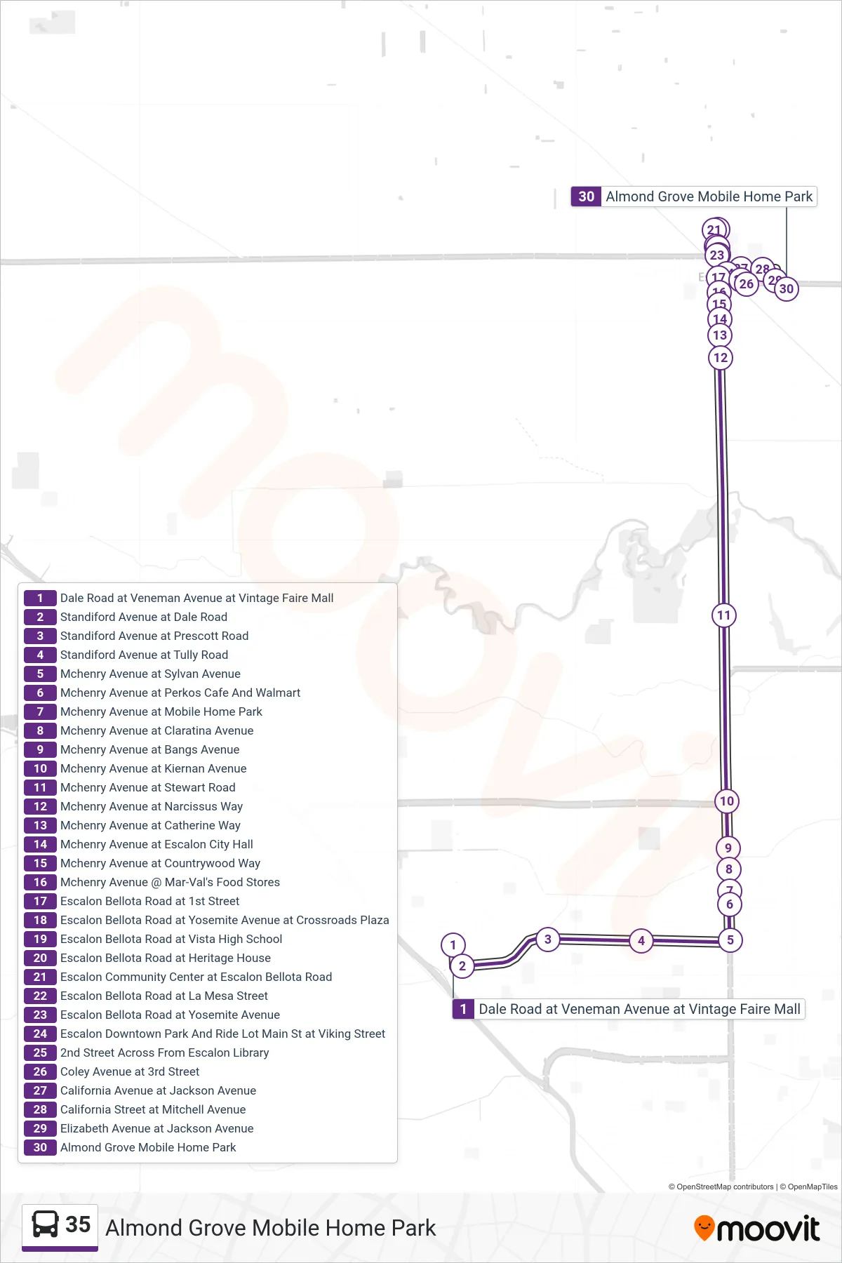
Stops list (35 - Almond Grove Mobile Home Park)
- Dale Road at Veneman Avenue at Vintage Faire Mall
- Standiford Avenue at Dale Road
- Standiford Avenue at Prescott Road
- Standiford Avenue at Tully Road
- Mchenry Avenue at Sylvan Avenue
- Mchenry Avenue at Perkos Cafe And Walmart
- Mchenry Avenue at Mobile Home Park
- Mchenry Avenue at Claratina Avenue
- Mchenry Avenue at Bangs Avenue
- Mchenry Avenue at Kiernan Avenue
- Mchenry Avenue at Stewart Road
- Mchenry Avenue at Narcissus Way
- Mchenry Avenue at Catherine Way
- Mchenry Avenue at Escalon City Hall
- Mchenry Avenue at Countrywood Way
- Mchenry Avenue @ Mar-Val's Food Stores
- Escalon Bellota Road at 1st Street
- Escalon Bellota Road at Yosemite Avenue at Crossroads Plaza
- Escalon Bellota Road at Vista High School
- Escalon Bellota Road at Heritage House
- Escalon Community Center at Escalon Bellota Road
- Escalon Bellota Road at La Mesa Street
- Escalon Bellota Road at Yosemite Avenue
- Escalon Downtown Park And Ride Lot Main St at Viking Street
- 2nd Street Across From Escalon Library
- Coley Avenue at 3rd Street
- California Avenue at Jackson Avenue
- California Street at Mitchell Avenue
- Elizabeth Avenue at Jackson Avenue
- Almond Grove Mobile Home Park