
35 Bus Route Map
View the 35 route map and see all 35 stops along the route. The map of 35 shows where the bus travels and the location of each stop, making it easy to understand the entire route at a glance.
Explore Valley Metro-Bus routes on the map and see where Valley Metro-Bus bus services operate. Use the 35 map to find bus stops and see how the 35 connects different areas along its trip.
All 35 stops on the map are displayed in route order, helping you follow the 35 bus from the first stop to the last.
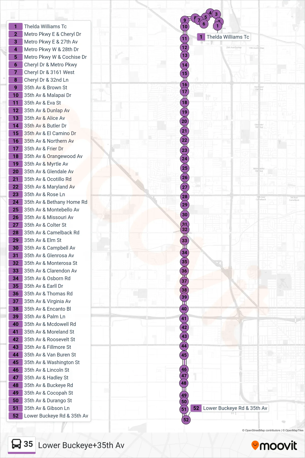
Stops list (35 - Lower Buckeye+35th Av)
- Thelda Williams Tc
- Metro Pkwy E & Cheryl Dr
- Metro Pkwy E & 27th Av
- Metro Pkwy W & 28th Dr
- Metro Pkwy W & Cochise Dr
- Cheryl Dr & Metro Pkwy
- Cheryl Dr & 3161 West
- Cheryl Dr & 32nd Ln
- 35th Av & Brown St
- 35th Av & Malapai Dr
- 35th Av & Eva St
- 35th Av & Dunlap Av
- 35th Av & Alice Av
- 35th Av & Butler Dr
- 35th Av & El Camino Dr
- 35th Av & Northern Av
- 35th Av & Frier Dr
- 35th Av & Orangewood Av
- 35th Av & Myrtle Av
- 35th Av & Glendale Av
- 35th Av & Ocotillo Rd
- 35th Av & Maryland Av
- 35th Av & Rose Ln
- 35th Av & Bethany Home Rd
- 35th Av & Montebello Av
- 35th Av & Missouri Av
- 35th Av & Colter St
- 35th Av & Camelback Rd
- 35th Av & Elm St
- 35th Av & Campbell Av
- 35th Av & Glenrosa Av
- 35th Av & Monterosa St
- 35th Av & Clarendon Av
- 35th Av & Osborn Rd
- 35th Av & Earll Dr
- 35th Av & Thomas Rd
- 35th Av & Virginia Av
- 35th Av & Encanto Bl
- 35th Av & Palm Ln
- 35th Av & Mcdowell Rd
- 35th Av & Moreland St
- 35th Av & Roosevelt St
- 35th Av & Fillmore St
- 35th Av & Van Buren St
- 35th Av & Washington St
- 35th Av & Lincoln St
- 35th Av & Hadley St
- 35th Av & Buckeye Rd
- 35th Av & Cocopah St
- 35th Av & Durango St
- 35th Av & Gibson Ln
- Lower Buckeye Rd & 35th Av