
35 Bus Route Map
View the 35 route map and see all 35 stops along the route. The map of 35 shows where the bus travels and the location of each stop, making it easy to understand the entire route at a glance.
Explore Santa Cruz Metro routes on the map and see where Santa Cruz Metro bus services operate. Use the 35 map to find bus stops and see how the 35 connects different areas along its trip.
All 35 stops on the map are displayed in route order, helping you follow the 35 bus from the first stop to the last.
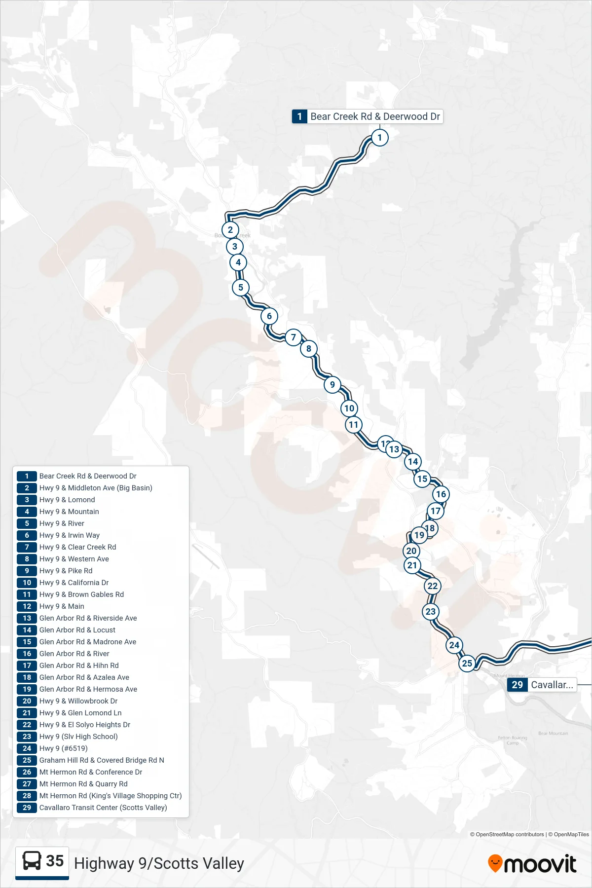
Stops list (35 - Highway 9 To Scotts Valley Transit Center)
- Bear Creek Rd & Deerwood Dr
- Hwy 9 & Middleton Ave (Big Basin)
- Hwy 9 & Lomond
- Hwy 9 & Mountain
- Hwy 9 & River
- Hwy 9 & Irwin Way
- Hwy 9 & Clear Creek Rd
- Hwy 9 & Western Ave
- Hwy 9 & Pike Rd
- Hwy 9 & California Dr
- Hwy 9 & Brown Gables Rd
- Hwy 9 & Main
- Glen Arbor Rd & Riverside Ave
- Glen Arbor Rd & Locust
- Glen Arbor Rd & Madrone Ave
- Glen Arbor Rd & River
- Glen Arbor Rd & Hihn Rd
- Glen Arbor Rd & Azalea Ave
- Glen Arbor Rd & Hermosa Ave
- Hwy 9 & Willowbrook Dr
- Hwy 9 & Glen Lomond Ln
- Hwy 9 & El Solyo Heights Dr
- Hwy 9 (Slv High School)
- Hwy 9 (#6519)
- Graham Hill Rd & Covered Bridge Rd N
- Mt Hermon Rd & Conference Dr
- Mt Hermon Rd & Quarry Rd
- Mt Hermon Rd (King's Village Shopping Ctr)
- Cavallaro Transit Center (Scotts Valley)
Change direction
- Route Map - 35 - Hwy 9/Scotts Valley To Boulder Creek Country Club
- Route Map - 35 - Highway 9 To Sylvan
- Route Map - 35 - Highway 9 To Sylvan Ave via Glen Arbor/Bear Creek
- Route Map - 35 - Highway 9/Scotts Valley
- Route Map - 35 - Auto Generated-59
- Route Map - 35 - Highway 9 To Bear Creek
- Route Map - 35 - Highway 9/Scotts Valley