
35 Bus Route Map
View the 35 route map and see all 35 stops along the route. The map of 35 shows where the bus travels and the location of each stop, making it easy to understand the entire route at a glance.
Explore County Connection routes on the map and see where County Connection bus services operate. Use the 35 map to find bus stops and see how the 35 connects different areas along its trip.
All 35 stops on the map are displayed in route order, helping you follow the 35 bus from the first stop to the last.
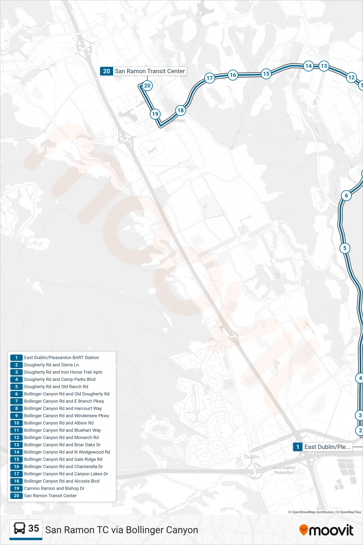
Stops list (35 - San Ramon TC via Bollinger Canyon)
- East Dublin/Pleasanton BART Station
- Dougherty Rd and Sierra Ln
- Dougherty Rd and Iron Horse Trail Apts
- Dougherty Rd and Camp Parks Blvd
- Dougherty Rd and Old Ranch Rd
- Bollinger Canyon Rd and Old Dougherty Rd
- Bollinger Canyon Rd and E Branch Pkwy
- Bollinger Canyon Rd and Harcourt Way
- Bollinger Canyon Rd and Windemere Pkwy
- Bollinger Canyon Rd and Albion Rd
- Bollinger Canyon Rd and Bluehart Way
- Bollinger Canyon Rd and Monarch Rd
- Bollinger Canyon Rd and Briar Oaks Dr
- Bollinger Canyon Rd and N Wedgewood Rd
- Bollinger Canyon Rd and Gale Ridge Rd
- Bollinger Canyon Rd and Chanterella Dr
- Bollinger Canyon Rd and Canyon Lakes Dr
- Bollinger Canyon Rd and Alcosta Blvd
- Camino Ramon and Bishop Dr
- San Ramon Transit Center