
350 Bus Route Map
View the 350 route map and see all 350 stops along the route. The map of 350 shows where the bus travels and the location of each stop, making it easy to understand the entire route at a glance.
Explore BOGESTRA BUS routes on the map and see where BOGESTRA BUS bus services operate. Use the 350 map to find bus stops and see how the 350 connects different areas along its trip.
All 350 stops on the map are displayed in route order, helping you follow the 350 bus from the first stop to the last.
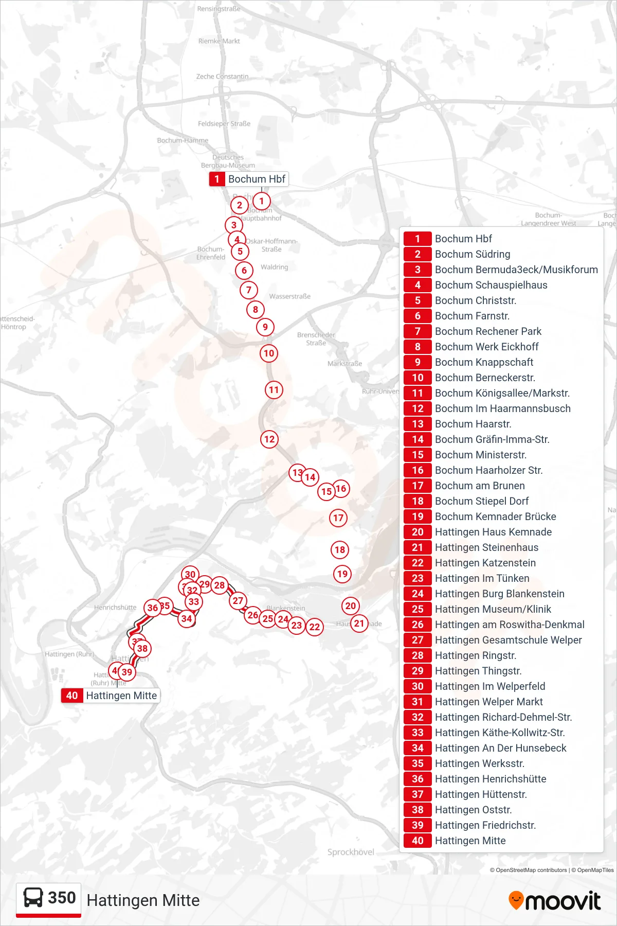
Stops list (350 - Hattingen Mitte)
- Bochum Hbf
- Bochum Südring
- Bochum Bermuda3eck/Musikforum
- Bochum Schauspielhaus
- Bochum Christstr.
- Bochum Farnstr.
- Bochum Rechener Park
- Bochum Werk Eickhoff
- Bochum Knappschaft
- Bochum Berneckerstr.
- Bochum Königsallee/Markstr.
- Bochum Im Haarmannsbusch
- Bochum Haarstr.
- Bochum Gräfin-Imma-Str.
- Bochum Ministerstr.
- Bochum Haarholzer Str.
- Bochum am Brunen
- Bochum Stiepel Dorf
- Bochum Kemnader Brücke
- Hattingen Haus Kemnade
- Hattingen Steinenhaus
- Hattingen Katzenstein
- Hattingen Im Tünken
- Hattingen Burg Blankenstein
- Hattingen Museum/Klinik
- Hattingen am Roswitha-Denkmal
- Hattingen Gesamtschule Welper
- Hattingen Ringstr.
- Hattingen Thingstr.
- Hattingen Im Welperfeld
- Hattingen Welper Markt
- Hattingen Richard-Dehmel-Str.
- Hattingen Käthe-Kollwitz-Str.
- Hattingen An Der Hunsebeck
- Hattingen Werksstr.
- Hattingen Henrichshütte
- Hattingen Hüttenstr.
- Hattingen Oststr.
- Hattingen Friedrichstr.
- Hattingen Mitte