
356 Bus Route Map
View the 356 route map and see all 356 stops along the route. The map of 356 shows where the bus travels and the location of each stop, making it easy to understand the entire route at a glance.
Explore Verkehrsbetriebe Mittelrhein VREM routes on the map and see where Verkehrsbetriebe Mittelrhein VREM bus services operate. Use the 356 map to find bus stops and see how the 356 connects different areas along its trip.
All 356 stops on the map are displayed in route order, helping you follow the 356 bus from the first stop to the last.
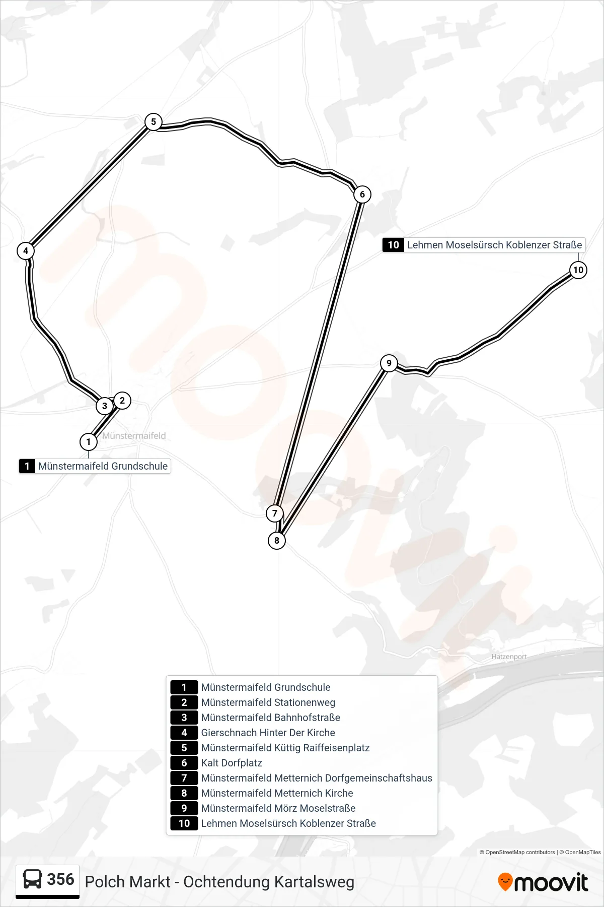
Stops list (356 - Lehmen Moselsürsch Koblenzer Straße)
- Münstermaifeld Grundschule
- Münstermaifeld Stationenweg
- Münstermaifeld Bahnhofstraße
- Gierschnach Hinter Der Kirche
- Münstermaifeld Küttig Raiffeisenplatz
- Kalt Dorfplatz
- Münstermaifeld Metternich Dorfgemeinschaftshaus
- Münstermaifeld Metternich Kirche
- Münstermaifeld Mörz Moselstraße
- Lehmen Moselsürsch Koblenzer Straße
Change direction
- Route Map - 356 - Münstermaifeld Grundschule
- Route Map - 356 - Polch Förderschule
- Route Map - 356 - Ochtendung Plaidter Straße
- Route Map - 356 - Münstermaifeld Gymnasium
- Route Map - 356 - Polch Kaan Bürgerhaus
- Route Map - 356 - Kalt Dorfplatz
- Route Map - 356 - Ochtendung Kartalsweg
- Route Map - 356 - Polch Markt
- Route Map - 356 - Polch St. Georgenstraße
- Route Map - 356 - Lonnig Auf Der Klostermauer
- Route Map - 356 - Polch Schwalbennest
- Route Map - 356 - Ochtendung Schillerstraße
- Route Map - 356 - Polch Stadion
- Route Map - 356 - Kobern-Gondorf Achterspannerhöfe
- Route Map - 356 - Kerben Bürgerhaus
- Route Map - 356 - Kerben Minkelfeld