
357 Bus Route Map
View the 357 route map and see all 357 stops along the route. The map of 357 shows where the bus travels and the location of each stop, making it easy to understand the entire route at a glance.
Explore Verkehrsbetriebe Mittelrhein VREM routes on the map and see where Verkehrsbetriebe Mittelrhein VREM bus services operate. Use the 357 map to find bus stops and see how the 357 connects different areas along its trip.
All 357 stops on the map are displayed in route order, helping you follow the 357 bus from the first stop to the last.
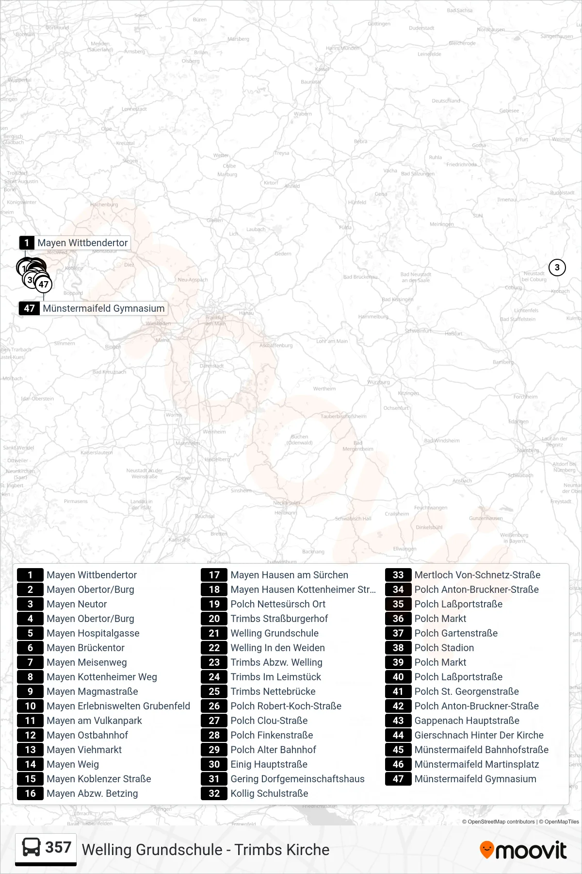
Stops list (357 - Münstermaifeld Gymnasium)
- Mayen Wittbendertor
- Mayen Obertor/Burg
- Mayen Neutor
- Mayen Obertor/Burg
- Mayen Hospitalgasse
- Mayen Brückentor
- Mayen Meisenweg
- Mayen Kottenheimer Weg
- Mayen Magmastraße
- Mayen Erlebniswelten Grubenfeld
- Mayen am Vulkanpark
- Mayen Ostbahnhof
- Mayen Viehmarkt
- Mayen Weig
- Mayen Koblenzer Straße
- Mayen Abzw. Betzing
- Mayen Hausen am Sürchen
- Mayen Hausen Kottenheimer Straße
- Polch Nettesürsch Ort
- Trimbs Straßburgerhof
- Welling Grundschule
- Welling In den Weiden
- Trimbs Abzw. Welling
- Trimbs Im Leimstück
- Trimbs Nettebrücke
- Polch Robert-Koch-Straße
- Polch Clou-Straße
- Polch Finkenstraße
- Polch Alter Bahnhof
- Einig Hauptstraße
- Gering Dorfgemeinschaftshaus
- Kollig Schulstraße
- Mertloch Von-Schnetz-Straße
- Polch Anton-Bruckner-Straße
- Polch Laßportstraße
- Polch Markt
- Polch Gartenstraße
- Polch Stadion
- Polch Markt
- Polch Laßportstraße
- Polch St. Georgenstraße
- Polch Anton-Bruckner-Straße
- Gappenach Hauptstraße
- Gierschnach Hinter Der Kirche
- Münstermaifeld Bahnhofstraße
- Münstermaifeld Martinsplatz
- Münstermaifeld Gymnasium
Change direction
- Route Map - 357 - Polch Stadion
- Route Map - 357 - Welling Grundschule
- Route Map - 357 - Kottenheim Friedhof
- Route Map - 357 - Polch Gartenstraße
- Route Map - 357 - Trimbs Im Leimstück
- Route Map - 357 - Polch Schwalbennest
- Route Map - 357 - Polch Stadion
- Route Map - 357 - Mayen Obertor/Burg
- Route Map - 357 - Trimbs Kirche
- Route Map - 357 - Polch Finkenstraße
- Route Map - 357 - Mayen Berufsschule
- Route Map - 357 - Mertloch Kirche
- Route Map - 357 - Polch Förderschule
- Route Map - 357 - Polch Nettesürsch Ort
- Route Map - 357 - Polch Anton-Bruckner-Straße
- Route Map - 357 - Mayen Gymnasium