
36 Bus Route Map
View the 36 route map and see all 36 stops along the route. The map of 36 shows where the bus travels and the location of each stop, making it easy to understand the entire route at a glance.
Explore Regional Transportation District routes on the map and see where Regional Transportation District bus services operate. Use the 36 map to find bus stops and see how the 36 connects different areas along its trip.
All 36 stops on the map are displayed in route order, helping you follow the 36 bus from the first stop to the last.
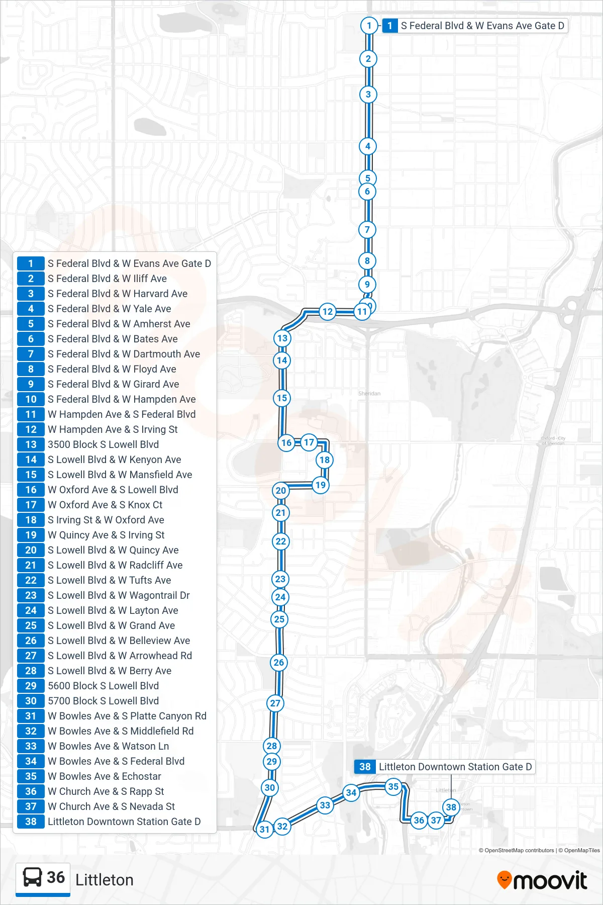
Stops list (36 - Littleton)
- S Federal Blvd & W Evans Ave Gate D
- S Federal Blvd & W Iliff Ave
- S Federal Blvd & W Harvard Ave
- S Federal Blvd & W Yale Ave
- S Federal Blvd & W Amherst Ave
- S Federal Blvd & W Bates Ave
- S Federal Blvd & W Dartmouth Ave
- S Federal Blvd & W Floyd Ave
- S Federal Blvd & W Girard Ave
- S Federal Blvd & W Hampden Ave
- W Hampden Ave & S Federal Blvd
- W Hampden Ave & S Irving St
- 3500 Block S Lowell Blvd
- S Lowell Blvd & W Kenyon Ave
- S Lowell Blvd & W Mansfield Ave
- W Oxford Ave & S Lowell Blvd
- W Oxford Ave & S Knox Ct
- S Irving St & W Oxford Ave
- W Quincy Ave & S Irving St
- S Lowell Blvd & W Quincy Ave
- S Lowell Blvd & W Radcliff Ave
- S Lowell Blvd & W Tufts Ave
- S Lowell Blvd & W Wagontrail Dr
- S Lowell Blvd & W Layton Ave
- S Lowell Blvd & W Grand Ave
- S Lowell Blvd & W Belleview Ave
- S Lowell Blvd & W Arrowhead Rd
- S Lowell Blvd & W Berry Ave
- 5600 Block S Lowell Blvd
- 5700 Block S Lowell Blvd
- W Bowles Ave & S Platte Canyon Rd
- W Bowles Ave & S Middlefield Rd
- W Bowles Ave & Watson Ln
- W Bowles Ave & S Federal Blvd
- W Bowles Ave & Echostar
- W Church Ave & S Rapp St
- W Church Ave & S Nevada St
- Littleton Downtown Station Gate D