
36 Cable Car Route Map
View the 36 route map and see all 36 stops along the route. The map of 36 shows where the cable car travels and the location of each stop, making it easy to understand the entire route at a glance.
Explore KP Kyivpastrans routes on the map and see where KP Kyivpastrans cable car services operate. Use the 36 map to find cable car stations and see how the 36 connects different areas along its trip.
All 36 stops on the map are displayed in route order, helping you follow the 36 cable car from the first station to the last.
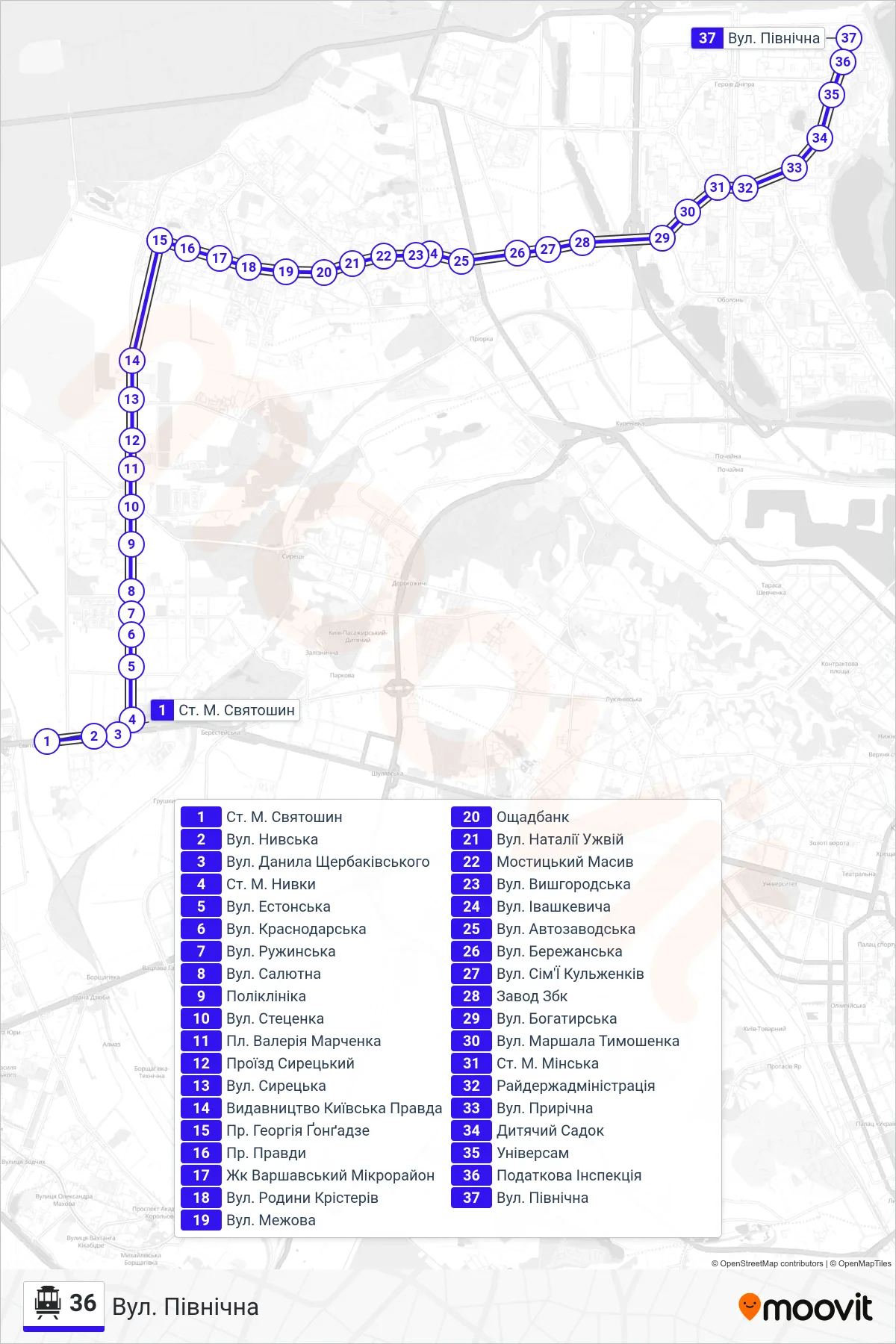
Stops list (36 - North Street)
- Sviatoshyn Metro Station
- Nyvska St
- Danylo Shcherbakivskyi Street
- Nyvky Metro Station
- Estonian Street
- Krasnodarska Street
- Ruzhynska St.
- Saliutna Street
- Polyclinic
- Stetsenka Street
- Valerii Marchenko Square
- Syretskyi Passage
- Syretska Street
- Kyivska Pravda Publishing House
- Heorhii Gongadze Ave
- Pravdy Ave
- Varshavskyi Microdistrict
- Krister Family St
- Mezhova Street
- Oschadbank
- Nataliia Uzhvii Street
- Mostytskyi District
- Vyshhorodska Street
- Ivashkevych Street
- Avtozavodska Street
- Berezhanska Street
- Kulzhenkiv Family Street
- ZBK Factory
- Bohatyrska Street
- Marshal Tymoshenko Street
- Minska Metro Station
- District State Administration
- Pryrichna Street
- Kindergarten
- Universam
- Tax Inspection
- North Street