
360 A Bus Route Map
View the 360 A route map and see all 360 A stops along the route. The map of 360 A shows where the bus travels and the location of each stop, making it easy to understand the entire route at a glance.
Explore Arezzo, Florence and Provinces - Tuscan Bus Lines routes on the map and see where Arezzo, Florence and Provinces - Tuscan Bus Lines bus services operate. Use the 360 A map to find bus stops and see how the 360 A connects different areas along its trip.
All 360 A stops on the map are displayed in route order, helping you follow the 360 A bus from the first stop to the last.
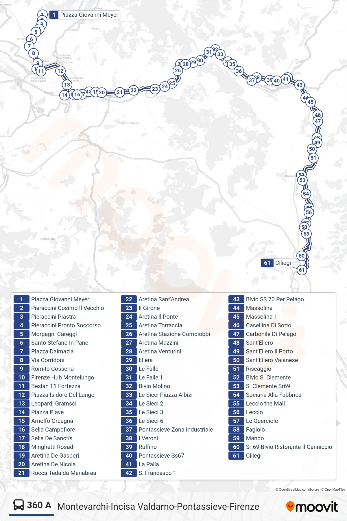
Stops list (360 A - Ciliegi)
- Giovanni Meyer Square
- Pieraccini Cosimo Il Vecchio
- Pieraccini Platform
- Pieraccini Emergency Room
- Morgagni Careggi
- Santo Stefano In Pane
- Dalmazia Square
- Corridoni Street
- Romito Cosseria
- Florence Montelungo Hub
- Beslan T1 Fortress
- Isidoro Del Lungo Square
- Leopardi Gramsci
- Piave Square
- Arnolfo Orcagna
- Campofiore Saddle
- Sella De Sanctis
- Minghetti Rosadi
- Aretina De Gasperi
- Aretina De Nicola
- Rocca Tedalda Menabrea
- Aretina Sant'Andrea
- Il Girone
- Aretina The Bridge
- Aretina Torraccia
- Aretina Compiobbi Station
- Aretina Mazzini
- Aretina Venturini
- Ellera
- Le Falle
- Le Falle 1
- Molino Junction
- Le Sieci Albizi Square
- Le Sieci 2
- Le Sieci 3
- Le Sieci 6
- Pontassieve Industrial Zone
- I Veroni
- Ruffino
- Pontassieve State Road 67
- La Palla
- St. Francis 1
- Junction SS 70 To Pelago
- Massolina
- Massolina 1
- Lower Casellina
- Pelago Coal Depot
- Sant'Ellero
- Sant'Ellero Port
- Sant'Ellero Vaianese
- Riscaggio
- St. Clemente Junction
- St. Clemente SR69
- Sociana At the Factory
- Leccio the Mall
- Leccio
- Le Querciole
- Fagiolo
- Mando
- Sr 69 Bivio Ristorante Il Canniccio
- Ciliegi