
360 A Bus Route Map
View the 360 A route map and see all 360 A stops along the route. The map of 360 A shows where the bus travels and the location of each stop, making it easy to understand the entire route at a glance.
Explore Florence and Province - Tuscan Bus Lines routes on the map and see where Florence and Province - Tuscan Bus Lines bus services operate. Use the 360 A map to find bus stops and see how the 360 A connects different areas along its trip.
All 360 A stops on the map are displayed in route order, helping you follow the 360 A bus from the first stop to the last.
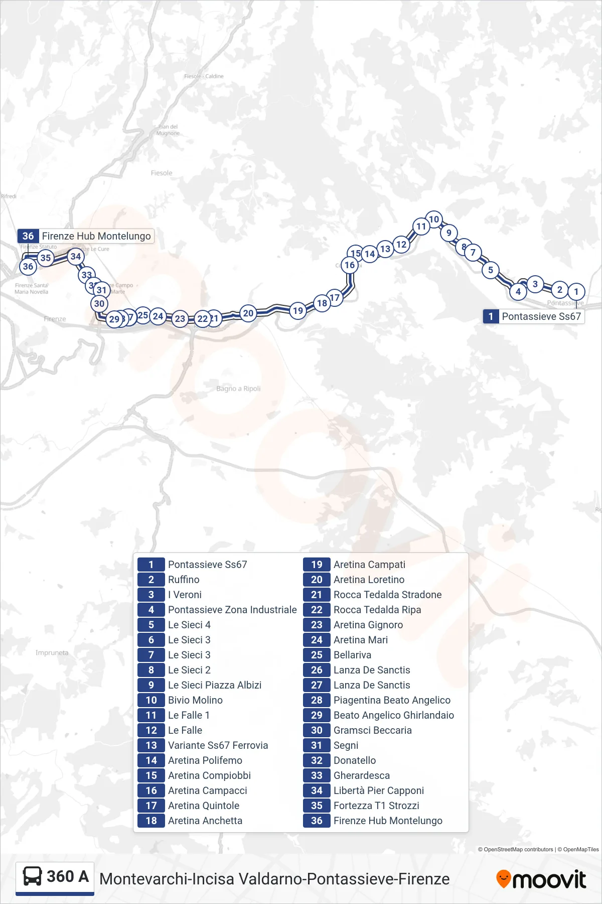
Stops list (360 A - Florence Montelungo Hub)
- Pontassieve State Road 67
- Ruffino
- I Veroni
- Pontassieve Industrial Zone
- Le Sieci 4
- Le Sieci 3
- Le Sieci 3
- Le Sieci 2
- Le Sieci Albizi Square
- Molino Junction
- Le Falle 1
- Le Falle
- SS67 Highway Railway Variant
- Aretina Polifemo
- Aretina Compiobbi
- Aretina Campacci
- Aretina Quintole
- Aretina Anchetta
- Aretina Campati
- Aretina Loretino
- Rocca Tedalda Main Road
- Rocca Tedalda Ripa
- Aretina Gignoro
- Aretina Mari
- Bellariva
- Lanza De Sanctis
- Lanza De Sanctis
- Piagentina Beato Angelico
- Beato Angelico Ghirlandaio
- Gramsci Beccaria
- Segni
- Donatello
- Gherardesca
- Liberty Pier Capponi
- Fortezza T1 Strozzi
- Florence Montelungo Hub