
366 Bus Route Map
View the 366 route map and see all 366 stops along the route. The map of 366 shows where the bus travels and the location of each stop, making it easy to understand the entire route at a glance.
Explore BOGESTRA BUS routes on the map and see where BOGESTRA BUS bus services operate. Use the 366 map to find bus stops and see how the 366 connects different areas along its trip.
All 366 stops on the map are displayed in route order, helping you follow the 366 bus from the first stop to the last.
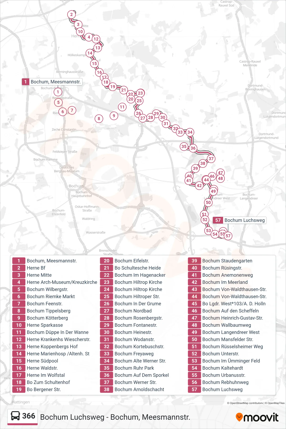
Stops list (366 - Bochum Luchsweg)
- Bochum, Meesmannstr.
- Herne Bf
- Herne Mitte
- Herne Arch-Museum/Kreuzkirche
- Bochum Wilbergstr.
- Bochum Riemke Markt
- Bochum Feenstr.
- Bochum Tippelsberg
- Bochum Kötterberg
- Herne Sparkasse
- Bochum Düppe In Der Wanne
- Herne Krankenhs Wiescherstr.
- Herne Koppenbergs Hof
- Herne Marienhosp /Altenh. St
- Herne Südpool
- Herne Waldstr.
- Herne Im Wolfstal
- Bo Zum Schultenhof
- Bo Bergener Str.
- Bochum Eifelstr.
- Bo Schultesche Heide
- Bochum Im Hagenacker
- Bochum Hiltrop Kirche
- Bochum Hiltrop Kirche
- Bochum Hiltroper Str.
- Bochum In Der Grume
- Bochum Nordbad
- Bochum Rosenbergstr.
- Bochum Fontanestr.
- Bochum Heinestr.
- Bochum Wodanstr.
- Bochum Kortebuschstr.
- Bochum Freyaweg
- Bochum Alte Werner Str.
- Bochum Ruhr Park
- Bochum Auf Dem Sporkel
- Bochum Werner Str.
- Bochum Arnoldschacht
- Bochum Staudengarten
- Bochum Rüsingstr.
- Bochum Anemonenweg
- Bochum Im Meerland
- Bochum Von-Waldthausen-Str.
- Bochum Von-Waldthausen-Str.
- Bo Lgdr. West*103/A. D. Holln
- Bochum Auf den Scheffeln
- Bochum Heinrich-Gustav-Str.
- Bochum Wallbaumweg
- Bochum Langendreer West
- Bochum Mansfelder Str.
- Bochum Rüsselsheimer Weg
- Bochum Unterstr.
- Bochum Im Ümminger Feld
- Bochum Kaltehardt
- Bochum Urbanusstr.
- Bochum Rebhuhnweg
- Bochum Luchsweg