
36A Bus Route Map
View the 36A route map and see all 36A stops along the route. The map of 36A shows where the bus travels and the location of each stop, making it easy to understand the entire route at a glance.
Explore DASH - Alexandria routes on the map and see where DASH - Alexandria bus services operate. Use the 36A map to find bus stops and see how the 36A connects different areas along its trip.
All 36A stops on the map are displayed in route order, helping you follow the 36A bus from the first stop to the last.
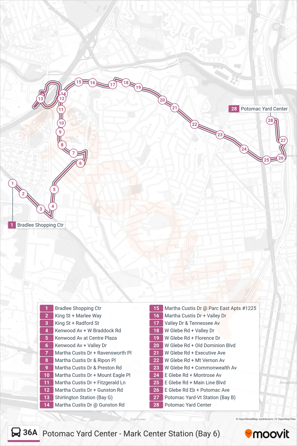
Stops list (36A - Potomac Yard Ctr Via M. Custis Dr)
- Bradlee Shopping Ctr
- King St + Marlee Way
- King St + Radford St
- Kenwood Av + W Braddock Rd
- Kenwood Av at Centre Plaza
- Kenwood Av + Valley Dr
- Martha Custis Dr + Ravensworth Pl
- Martha Custis Dr & Ripon Pl
- Martha Custis Dr & Preston Rd
- Martha Custis Dr + Mount Eagle Pl
- Martha Custis Dr + Fitzgerald Ln
- Martha Custis Dr + Gunston Rd
- Shirlington Station (Bay G)
- Martha Custis Dr @ Gunston Rd
- Martha Custis Dr @ Parc East Apts #1225
- Martha Custis Dr + Valley Dr
- Valley Dr & Tennessee Av
- W Glebe Rd + Valley Dr
- W Glebe Rd + Florence Dr
- W Glebe Rd + Old Dominion Blvd
- W Glebe Rd + Executive Ave
- W Glebe Rd + Mt Vernon Av
- W Glebe Rd + Commonwealth Av
- E Glebe Rd + Montrose Av
- E Glebe Rd + Main Line Blvd
- E Glebe Rd Eb + Potomac Ave
- Potomac Yard-Vt Station (Bay B)
- Potomac Yard Center