
37 Bus Route Map
View the 37 route map and see all 37 stops along the route. The map of 37 shows where the bus travels and the location of each stop, making it easy to understand the entire route at a glance.
Explore Bus Átha Cliath – Dublin Bus routes on the map and see where Bus Átha Cliath – Dublin Bus bus services operate. Use the 37 map to find bus stops and see how the 37 connects different areas along its trip.
All 37 stops on the map are displayed in route order, helping you follow the 37 bus from the first stop to the last.
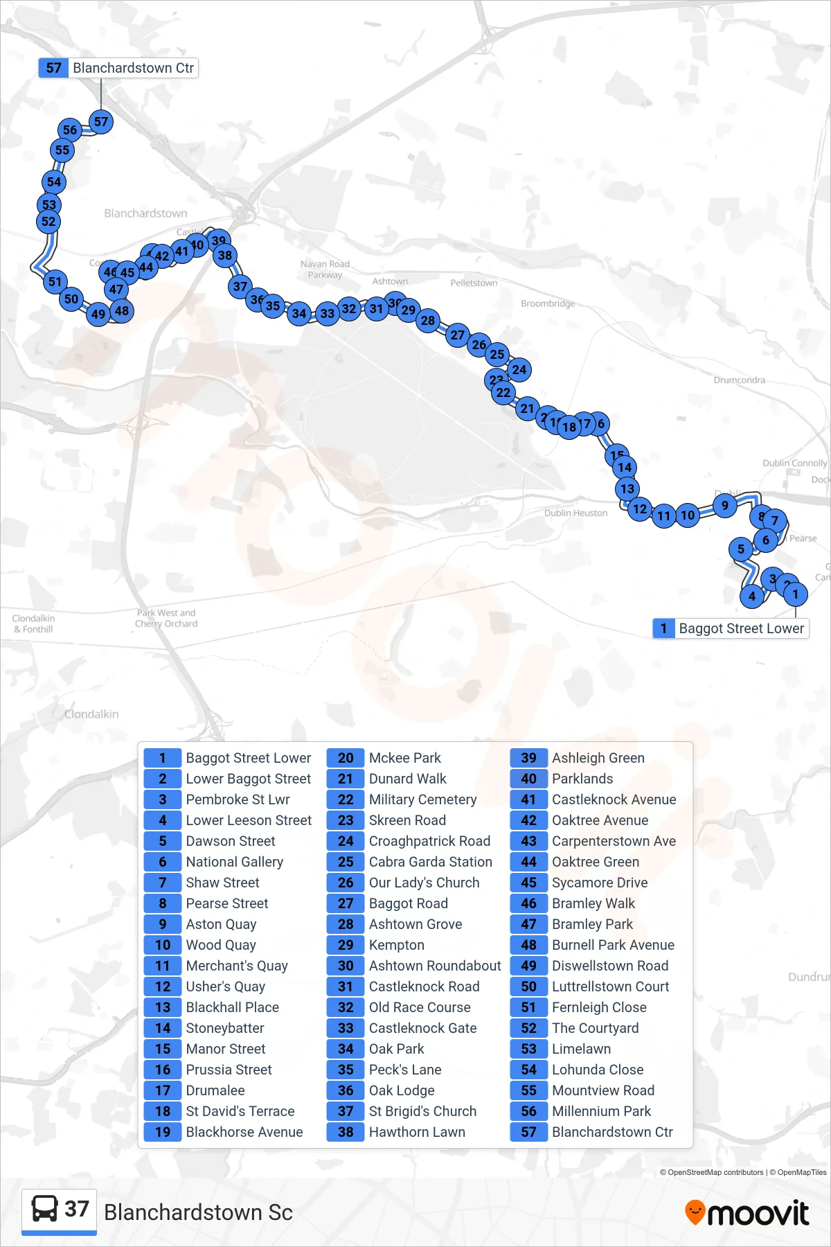
Stops list (37 - Blanchardstown Sc)
- Baggot Street Lower
- Lower Baggot Street
- Pembroke St Lwr
- Lower Leeson Street
- Dawson Street
- National Gallery
- Shaw Street
- Pearse Street
- Aston Quay
- Wood Quay
- Merchant's Quay
- Usher's Quay
- Blackhall Place
- Stoneybatter
- Manor Street
- Prussia Street
- Drumalee
- St David's Terrace
- Blackhorse Avenue
- Mckee Park
- Dunard Walk
- Military Cemetery
- Skreen Road
- Croaghpatrick Road
- Cabra Garda Station
- Our Lady's Church
- Baggot Road
- Ashtown Grove
- Kempton
- Ashtown Roundabout
- Castleknock Road
- Old Race Course
- Castleknock Gate
- Oak Park
- Peck's Lane
- Oak Lodge
- St Brigid's Church
- Hawthorn Lawn
- Ashleigh Green
- Parklands
- Castleknock Avenue
- Oaktree Avenue
- Carpenterstown Ave
- Oaktree Green
- Sycamore Drive
- Bramley Walk
- Bramley Park
- Burnell Park Avenue
- Diswellstown Road
- Luttrellstown Court
- Fernleigh Close
- The Courtyard
- Limelawn
- Lohunda Close
- Mountview Road
- Millennium Park
- Blanchardstown Ctr