
372 Bus Route Map
View the 372 route map and see all 372 stops along the route. The map of 372 shows where the bus travels and the location of each stop, making it easy to understand the entire route at a glance.
Explore Metropoline routes on the map and see where Metropoline bus services operate. Use the 372 map to find bus stops and see how the 372 connects different areas along its trip.
All 372 stops on the map are displayed in route order, helping you follow the 372 bus from the first stop to the last.
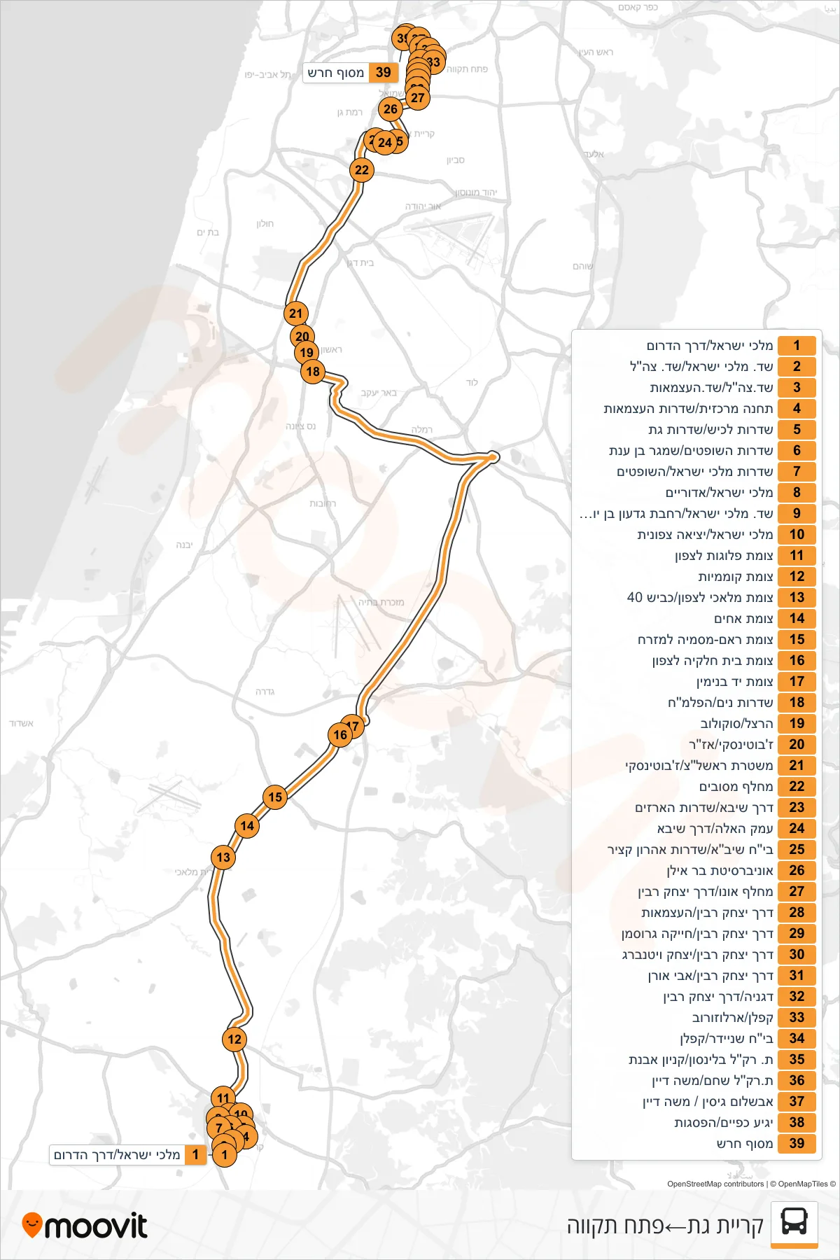
Stops list (372 - Kiryat Gat→Petah Tikva)
- Malchei Israel/Derech HaDarom
- Kings of Israel Blvd/IDF Blvd
- IDF Boulevard/Independence Boulevard
- Central Station/Independence Blvd
- Lachish Blvd/Gat Blvd
- Judges Boulevard/Shamgar Ben Anat
- Kings of Israel Boulevard/HaShoftim
- Malchei Israel/Adorayim
- Kings of Israel Boulevard/Gideon Ben Yoash Plaza
- Malchei Israel/North Exit
- Plugot Junction North
- Komemiyut Junction
- Malachi North Junction/Road 40
- Achim Junction
- Ra'am-Masmiya Junction Eastbound
- Beit Hilkiya Junction North
- Yad Binyamin Junction
- Nitzanim Boulevard/Palmach
- Herzl/Sokolov
- Jabotinsky/Azar
- Rishon LeZion Police/Jabotinsky
- Mesubim Interchange
- Sheba Road/HaArazim Boulevard
- Emek HaEla/Sheba Road
- Sheba Hospital/Aharon Katzir Boulevard
- Bar Ilan University
- Ono Interchange/Yitzhak Rabin Road
- Yitzhak Rabin Road/HaAtzmaut
- Yitzhak Rabin Road/Chaika Grossman
- Yitzhak Rabin Road/Yitzhak Vittenberg
- Yitzhak Rabin Road/Avi Oren
- Degania/Yitzhak Rabin Road
- Kaplan/Arlozorov
- Schneider Hospital/Kaplan
- Beilinson Light Rail Station/Avnet Mall
- Shoham Light Rail Station/Moshe Dayan
- Avshalom Gisin/Moshe Dayan
- Yegia Kapayim/HaPisgot
- Heresh Terminal