
375 Bus Route Map
View the 375 route map and see all 375 stops along the route. The map of 375 shows where the bus travels and the location of each stop, making it easy to understand the entire route at a glance.
Explore BOGESTRA BUS routes on the map and see where BOGESTRA BUS bus services operate. Use the 375 map to find bus stops and see how the 375 connects different areas along its trip.
All 375 stops on the map are displayed in route order, helping you follow the 375 bus from the first stop to the last.
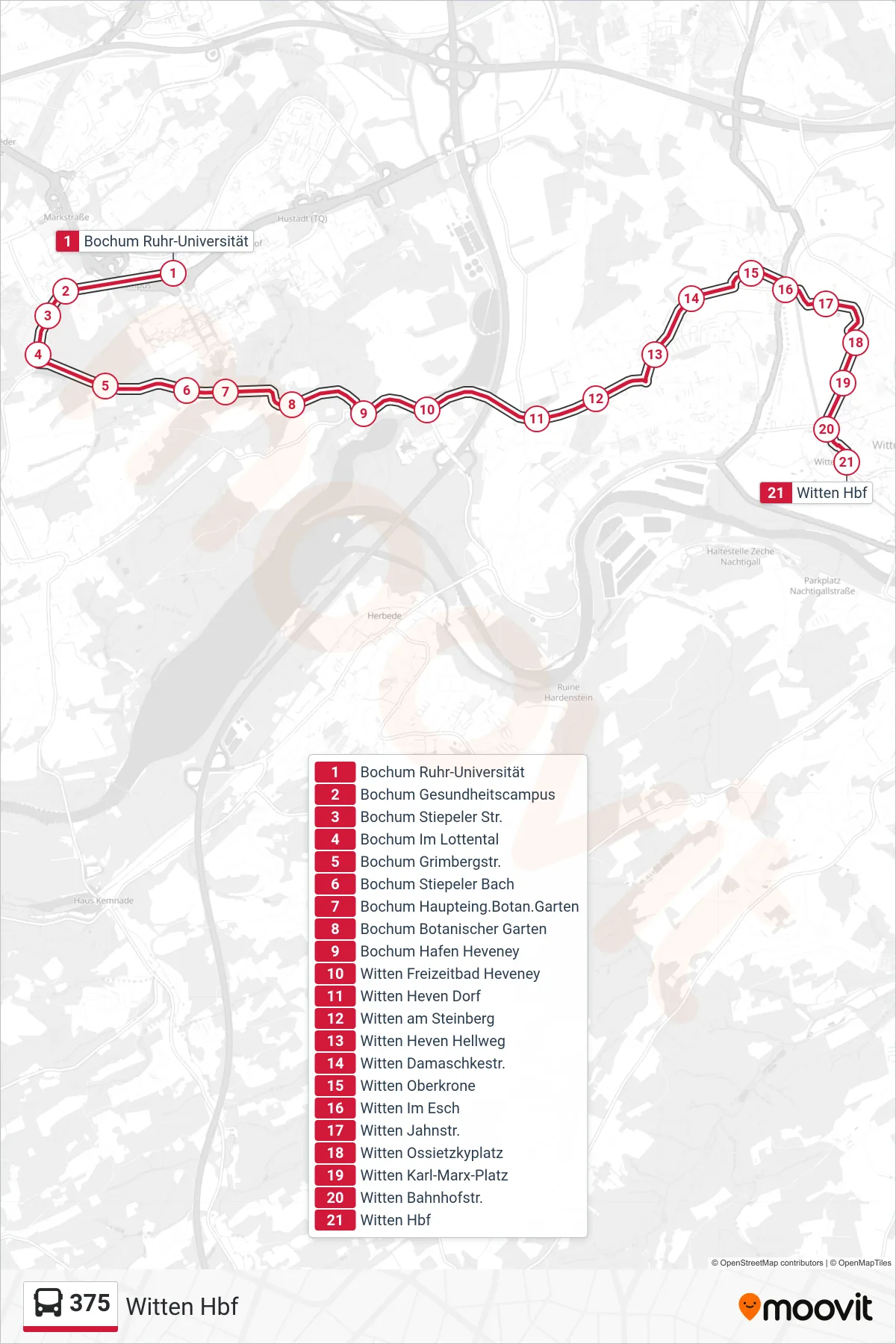
Stops list (375 - Witten Hbf)
- Bochum Ruhr-Universität
- Bochum Gesundheitscampus
- Bochum Stiepeler Str.
- Bochum Im Lottental
- Bochum Grimbergstr.
- Bochum Stiepeler Bach
- Bochum Haupteing.Botan.Garten
- Bochum Botanischer Garten
- Bochum Hafen Heveney
- Witten Freizeitbad Heveney
- Witten Heven Dorf
- Witten am Steinberg
- Witten Heven Hellweg
- Witten Damaschkestr.
- Witten Oberkrone
- Witten Im Esch
- Witten Jahnstr.
- Witten Ossietzkyplatz
- Witten Karl-Marx-Platz
- Witten Bahnhofstr.
- Witten Hbf
Change direction
- Route Map - 375 - Witten Kämpen
- Route Map - 375 - Witten Marienhospital
- Route Map - 375 - Witten Große Borbach
- Route Map - 375 - Witten Wartenberg
- Route Map - 375 - Witten Ossietzkyplatz
- Route Map - 375 - Witten Potthofstr.
- Route Map - 375 - Witten Wendeschleife am Hang
- Route Map - 375 - Bochum Ruhr-Universität