
38 Bus Route Map
View the 38 route map and see all 38 stops along the route. The map of 38 shows where the bus travels and the location of each stop, making it easy to understand the entire route at a glance.
Explore MBTA routes on the map and see where MBTA bus services operate. Use the 38 map to find bus stops and see how the 38 connects different areas along its trip.
All 38 stops on the map are displayed in route order, helping you follow the 38 bus from the first stop to the last.
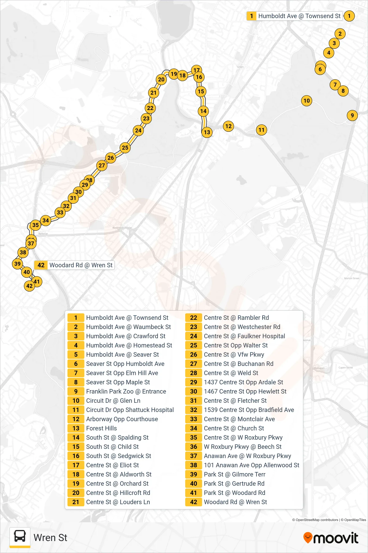
Stops list (38 - Wren St)
- Humboldt Ave @ Townsend St
- Humboldt Ave @ Waumbeck St
- Humboldt Ave @ Crawford St
- Humboldt Ave @ Homestead St
- Humboldt Ave @ Seaver St
- Seaver St Opp Humboldt Ave
- Seaver St Opp Elm Hill Ave
- Seaver St Opp Maple St
- Franklin Park Zoo @ Entrance
- Circuit Dr @ Glen Ln
- Circuit Dr Opp Shattuck Hospital
- Arborway Opp Courthouse
- Forest Hills
- South St @ Spalding St
- South St @ Child St
- South St @ Sedgwick St
- Centre St @ Eliot St
- Centre St @ Aldworth St
- Centre St @ Orchard St
- Centre St @ Hillcroft Rd
- Centre St @ Louders Ln
- Centre St @ Rambler Rd
- Centre St @ Westchester Rd
- Centre St @ Faulkner Hospital
- Centre St Opp Walter St
- Centre St @ Vfw Pkwy
- Centre St @ Buchanan Rd
- Centre St @ Weld St
- 1437 Centre St Opp Ardale St
- 1467 Centre St Opp Hewlett St
- Centre St @ Fletcher St
- 1539 Centre St Opp Bradfield Ave
- Centre St @ Montclair Ave
- Centre St @ Church St
- Centre St @ W Roxbury Pkwy
- W Roxbury Pkwy @ Beech St
- Anawan Ave @ W Roxbury Pkwy
- 101 Anawan Ave Opp Allenwood St
- Park St @ Gilmore Terr
- Park St @ Gertrude Rd
- Park St @ Woodard Rd
- Woodard Rd @ Wren St