
38 Bus Route Map
View the 38 route map and see all 38 stops along the route. The map of 38 shows where the bus travels and the location of each stop, making it easy to understand the entire route at a glance.
Explore Bus Átha Cliath – Dublin Bus routes on the map and see where Bus Átha Cliath – Dublin Bus bus services operate. Use the 38 map to find bus stops and see how the 38 connects different areas along its trip.
All 38 stops on the map are displayed in route order, helping you follow the 38 bus from the first stop to the last.
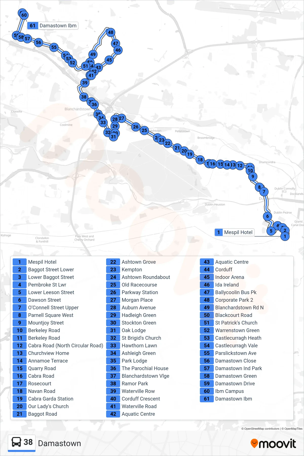
Stops list (38 - Damastown)
- Mespil Hotel
- Baggot Street Lower
- Lower Baggot Street
- Pembroke St Lwr
- Lower Leeson Street
- Dawson Street
- O'Connell Street Upper
- Parnell Square West
- Mountjoy Street
- Berkeley Road
- Berkeley Road
- Cabra Road (North Circular Road)
- Churchview Home
- Annamoe Terrace
- Quarry Road
- Cabra Road
- Rosecourt
- Navan Road
- Cabra Garda Station
- Our Lady's Church
- Baggot Road
- Ashtown Grove
- Kempton
- Ashtown Roundabout
- Old Racecourse
- Parkway Station
- Morgan Place
- Auburn Avenue
- Hadleigh Green
- Stockton Green
- Oak Lodge
- St Brigid's Church
- Hawthorn Lawn
- Ashleigh Green
- Park Lodge
- The Parochial House
- Blanchardstown Vlge
- Ramor Park
- Waterville Row
- Corduff Crescent
- Waterville Road
- Aquatic Centre
- Aquatic Centre
- Corduff
- Indoor Arena
- Ida Ireland
- Ballycoolin Bus Pk
- Corporate Park 2
- Blanchardstown Rd N
- Blackcourt Road
- St Patrick's Church
- Warrenstown Green
- Castlecurragh Heath
- Castlecurragh Vale
- Parslickstown Ave
- Damastown Close
- Damastown Ind Park
- Damastown Green
- Damastown Drive
- Ibm Campus
- Damastown Ibm