
38 Bus Route Map
View the 38 route map and see all 38 stops along the route. The map of 38 shows where the bus travels and the location of each stop, making it easy to understand the entire route at a glance.
Explore Metro Transit-City of Madison routes on the map and see where Metro Transit-City of Madison bus services operate. Use the 38 map to find bus stops and see how the 38 connects different areas along its trip.
All 38 stops on the map are displayed in route order, helping you follow the 38 bus from the first stop to the last.
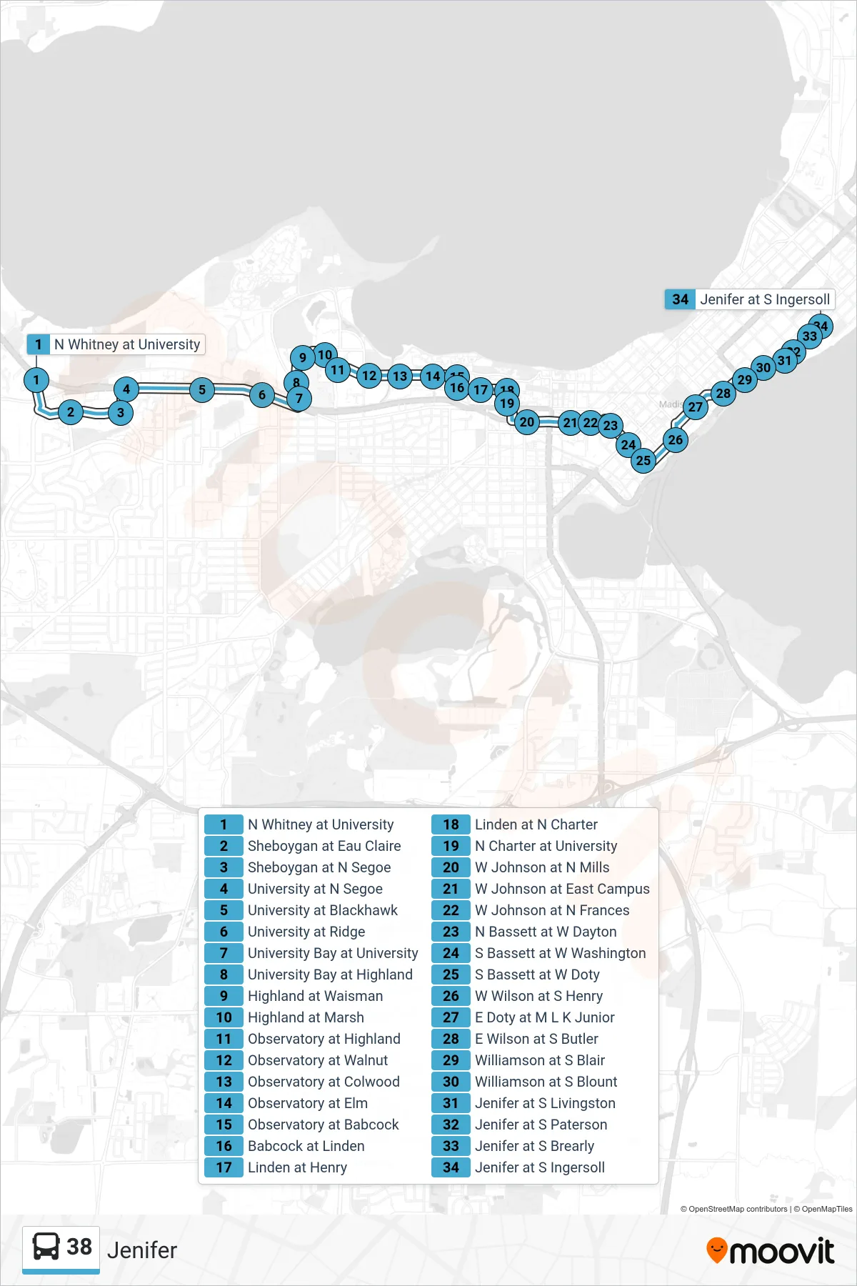
Stops list (38 - Jenifer)
- N Whitney at University
- Sheboygan at Eau Claire
- Sheboygan at N Segoe
- University at N Segoe
- University at Blackhawk
- University at Ridge
- University Bay at University
- University Bay at Highland
- Highland at Waisman
- Highland at Marsh
- Observatory at Highland
- Observatory at Walnut
- Observatory at Colwood
- Observatory at Elm
- Observatory at Babcock
- Babcock at Linden
- Linden at Henry
- Linden at N Charter
- N Charter at University
- W Johnson at N Mills
- W Johnson at East Campus
- W Johnson at N Frances
- N Bassett at W Dayton
- S Bassett at W Washington
- S Bassett at W Doty
- W Wilson at S Henry
- E Doty at M L K Junior
- E Wilson at S Butler
- Williamson at S Blair
- Williamson at S Blount
- Jenifer at S Livingston
- Jenifer at S Paterson
- Jenifer at S Brearly
- Jenifer at S Ingersoll