
38 Bus Route Map
View the 38 route map and see all 38 stops along the route. The map of 38 shows where the bus travels and the location of each stop, making it easy to understand the entire route at a glance.
Explore Pittsburgh Regional Transit routes on the map and see where Pittsburgh Regional Transit bus services operate. Use the 38 map to find bus stops and see how the 38 connects different areas along its trip.
All 38 stops on the map are displayed in route order, helping you follow the 38 bus from the first stop to the last.
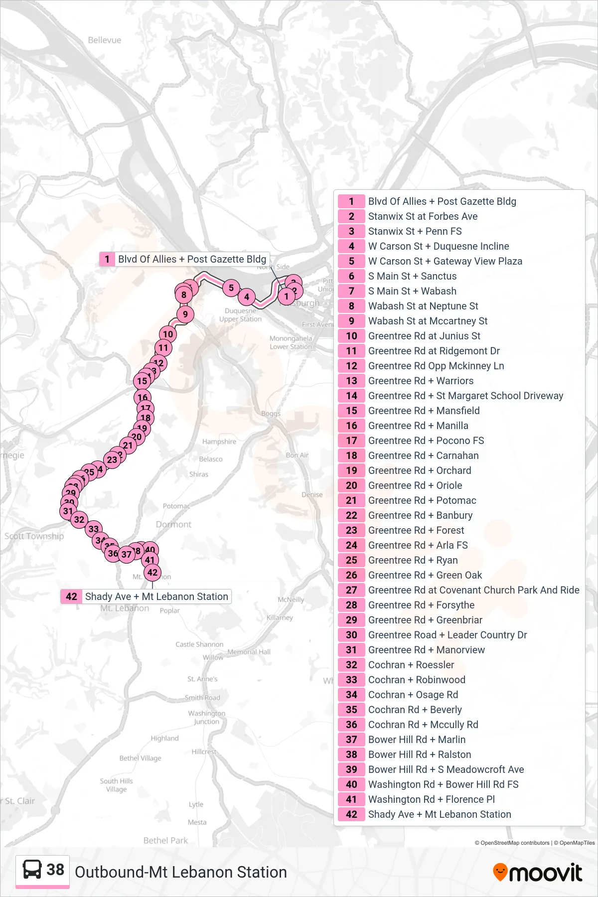
Stops list (38 - Outbound-Mt Lebanon Station)
- Blvd Of Allies + Post Gazette Bldg
- Stanwix St at Forbes Ave
- Stanwix St + Penn FS
- W Carson St + Duquesne Incline
- W Carson St + Gateway View Plaza
- S Main St + Sanctus
- S Main St + Wabash
- Wabash St at Neptune St
- Wabash St at Mccartney St
- Greentree Rd at Junius St
- Greentree Rd at Ridgemont Dr
- Greentree Rd Opp Mckinney Ln
- Greentree Rd + Warriors
- Greentree Rd + St Margaret School Driveway
- Greentree Rd + Mansfield
- Greentree Rd + Manilla
- Greentree Rd + Pocono FS
- Greentree Rd + Carnahan
- Greentree Rd + Orchard
- Greentree Rd + Oriole
- Greentree Rd + Potomac
- Greentree Rd + Banbury
- Greentree Rd + Forest
- Greentree Rd + Arla FS
- Greentree Rd + Ryan
- Greentree Rd + Green Oak
- Greentree Rd at Covenant Church Park And Ride
- Greentree Rd + Forsythe
- Greentree Rd + Greenbriar
- Greentree Road + Leader Country Dr
- Greentree Rd + Manorview
- Cochran + Roessler
- Cochran + Robinwood
- Cochran + Osage Rd
- Cochran Rd + Beverly
- Cochran Rd + Mccully Rd
- Bower Hill Rd + Marlin
- Bower Hill Rd + Ralston
- Bower Hill Rd + S Meadowcroft Ave
- Washington Rd + Bower Hill Rd FS
- Washington Rd + Florence Pl
- Shady Ave + Mt Lebanon Station