
38 Bus Route Map
View the 38 route map and see all 38 stops along the route. The map of 38 shows where the bus travels and the location of each stop, making it easy to understand the entire route at a glance.
Explore Montgomery County Ride On routes on the map and see where Montgomery County Ride On bus services operate. Use the 38 map to find bus stops and see how the 38 connects different areas along its trip.
All 38 stops on the map are displayed in route order, helping you follow the 38 bus from the first stop to the last.
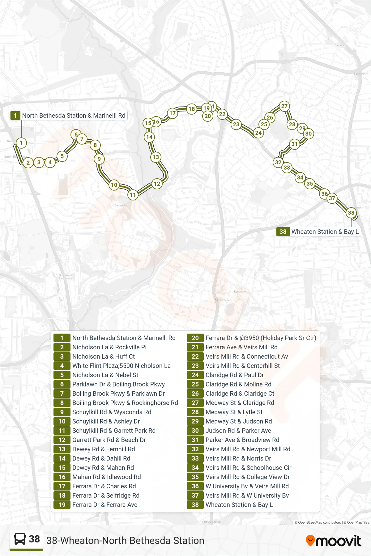
Stops list (38 - Wheaton Via Hp)
- North Bethesda Station & Marinelli Rd
- Nicholson La & Rockville Pi
- Nicholson La & Huff Ct
- White Flint Plaza;5500 Nicholson La
- Nicholson La & Nebel St
- Parklawn Dr & Boiling Brook Pkwy
- Boiling Brook Pkwy & Parklawn Dr
- Boiling Brook Pkwy & Rockinghorse Rd
- Schuylkill Rd & Wyaconda Rd
- Schuylkill Rd & Ashley Dr
- Schuylkill Rd & Garrett Park Rd
- Garrett Park Rd & Beach Dr
- Dewey Rd & Fernhill Rd
- Dewey Rd & Dahill Rd
- Dewey Rd & Mahan Rd
- Mahan Rd & Idlewood Rd
- Ferrara Dr & Charles Rd
- Ferrara Dr & Selfridge Rd
- Ferrara Dr & Ferrara Ave
- Ferrara Dr & @3950 (Holiday Park Sr Ctr)
- Ferrara Ave & Veirs Mill Rd
- Veirs Mill Rd & Connecticut Av
- Veirs Mill Rd & Centerhill St
- Claridge Rd & Paul Dr
- Claridge Rd & Moline Rd
- Claridge Rd & Claridge Ct
- Medway St & Claridge Rd
- Medway St & Lytle St
- Medway St & Judson Rd
- Judson Rd & Parker Ave
- Parker Ave & Broadview Rd
- Veirs Mill Rd & Newport Mill Rd
- Veirs Mill Rd & Norris Dr
- Veirs Mill Rd & Schoolhouse Cir
- Veirs Mill Rd & College View Dr
- W University Bv & Veirs Mill Rd
- Veirs Mill Rd & W University Bv
- Wheaton Station & Bay L
Change direction
- Route Map - 38 - North Bethesda Via Wheaton Plaza
- Route Map - 38 - Wheaton Via Wheaton Plaza
- Route Map - 38 - North Bethesda
- Route Map - 38 - Wheaton Via Holiday Park & Wheaton Plaza
- Route Map - 38 - Wheaton
- Route Map - 38 - North Bethesda Via Holiday Park & Wheaton Plaza
- Route Map - 38 - North Bethesda Via Holiday Park