
39 Bus Route Map
View the 39 route map and see all 39 stops along the route. The map of 39 shows where the bus travels and the location of each stop, making it easy to understand the entire route at a glance.
Explore Bus Átha Cliath – Dublin Bus routes on the map and see where Bus Átha Cliath – Dublin Bus bus services operate. Use the 39 map to find bus stops and see how the 39 connects different areas along its trip.
All 39 stops on the map are displayed in route order, helping you follow the 39 bus from the first stop to the last.
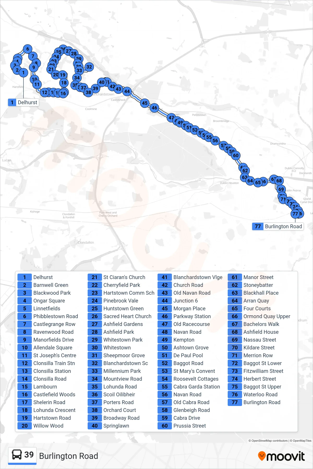
Stops list (39 - Burlington Road)
- Delhurst
- Barnwell Green
- Blackwood Park
- Ongar Square
- Linnetfields
- Phibblestown Road
- Castlegrange Row
- Ravenwood Road
- Manorfields Drive
- Allendale Square
- St Joseph's Centre
- Clonsilla Train Stn
- Clonsilla Station
- Clonsilla Road
- Lambourn
- Castlefield Woods
- Shelerin Road
- Lohunda Crescent
- Hartstown Road
- Willow Wood
- St Ciaran's Church
- Cherryfield Park
- Hartstown Comm Sch
- Pinebrook Vale
- Huntstown Green
- Sacred Heart Church
- Ashfield Gardens
- Ashfield Park
- Whitestown Park
- Whitestown
- Sheepmoor Grove
- Blanchardstown Sc
- Millennium Park
- Mountview Road
- Lohunda Road
- Scoil Oilibheir
- Porters Road
- Orchard Court
- Broadway Road
- Springlawn
- Blanchardstown Vlge
- Church Road
- Old Navan Road
- Junction 6
- Morgan Place
- Parkway Station
- Old Racecourse
- Navan Road
- Kempton
- Ashtown Grove
- De Paul Pool
- Baggot Road
- St Mary's Convent
- Roosevelt Cottages
- Cabra Garda Station
- Navan Road
- Old Cabra Road
- Glenbeigh Road
- Cabra Drive
- Prussia Street
- Manor Street
- Stoneybatter
- Blackhall Place
- Arran Quay
- Four Courts
- Ormond Quay Upper
- Bachelors Walk
- Ashfield House
- Nassau Street
- Kildare Street
- Merrion Row
- Baggot St Lower
- Fitzwilliam Street
- Herbert Street
- Baggot St Upper
- Waterloo Road
- Burlington Road