
3L Bus Route Map
View the 3L route map and see all 3L stops along the route. The map of 3L shows where the bus travels and the location of each stop, making it easy to understand the entire route at a glance.
Explore Regional Transportation District routes on the map and see where Regional Transportation District bus services operate. Use the 3L map to find bus stops and see how the 3L connects different areas along its trip.
All 3L stops on the map are displayed in route order, helping you follow the 3L bus from the first stop to the last.
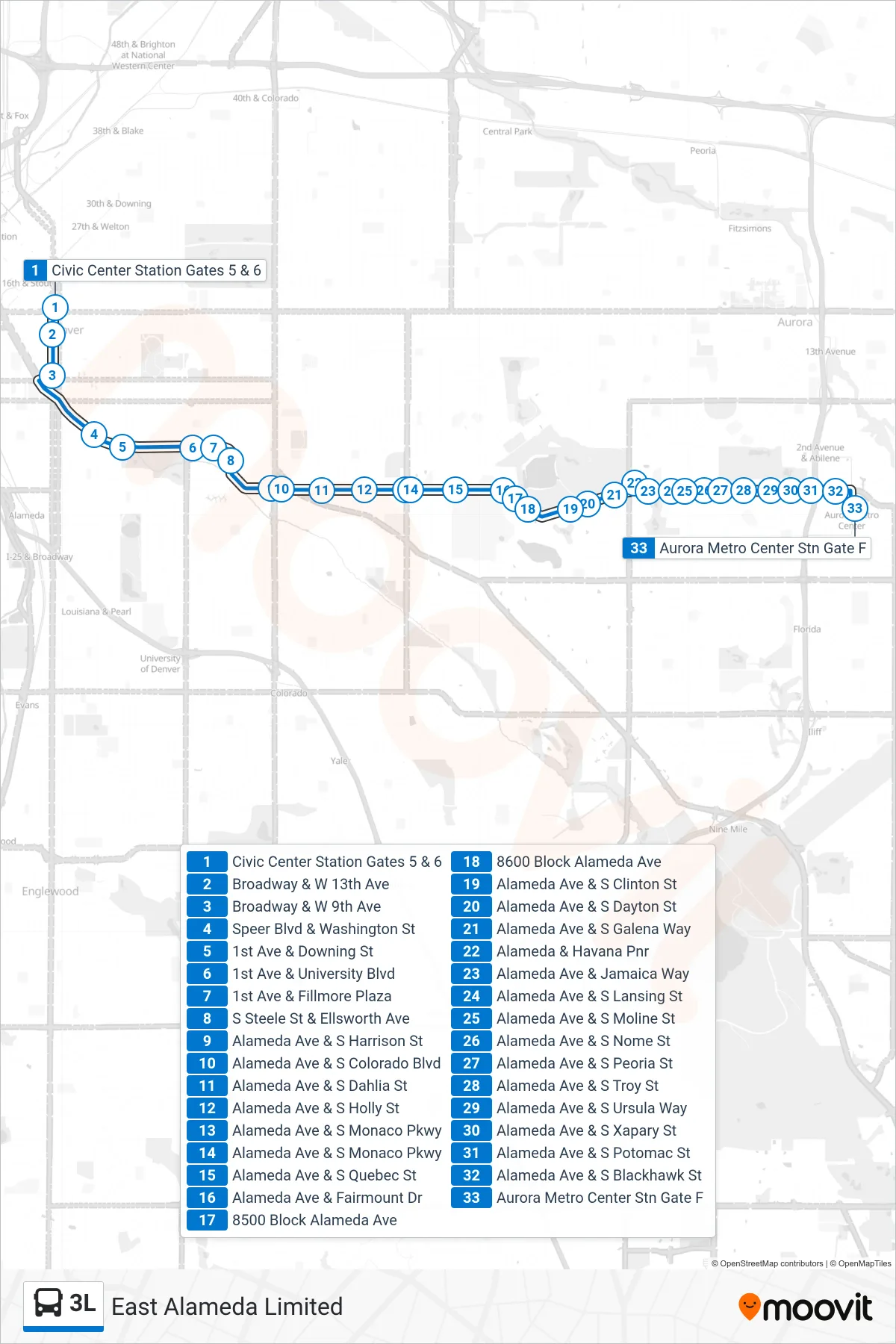
Stops list (3L - Aurora Met Ctr)
- Civic Center Station Gates 5 & 6
- Broadway & W 13th Ave
- Broadway & W 9th Ave
- Speer Blvd & Washington St
- 1st Ave & Downing St
- 1st Ave & University Blvd
- 1st Ave & Fillmore Plaza
- S Steele St & Ellsworth Ave
- Alameda Ave & S Harrison St
- Alameda Ave & S Colorado Blvd
- Alameda Ave & S Dahlia St
- Alameda Ave & S Holly St
- Alameda Ave & S Monaco Pkwy
- Alameda Ave & S Monaco Pkwy
- Alameda Ave & S Quebec St
- Alameda Ave & Fairmount Dr
- 8500 Block Alameda Ave
- 8600 Block Alameda Ave
- Alameda Ave & S Clinton St
- Alameda Ave & S Dayton St
- Alameda Ave & S Galena Way
- Alameda & Havana Pnr
- Alameda Ave & Jamaica Way
- Alameda Ave & S Lansing St
- Alameda Ave & S Moline St
- Alameda Ave & S Nome St
- Alameda Ave & S Peoria St
- Alameda Ave & S Troy St
- Alameda Ave & S Ursula Way
- Alameda Ave & S Xapary St
- Alameda Ave & S Potomac St
- Alameda Ave & S Blackhawk St
- Aurora Metro Center Stn Gate F