
3N Bus Route Map
View the 3N route map and see all 3N stops along the route. The map of 3N shows where the bus travels and the location of each stop, making it easy to understand the entire route at a glance.
Explore Livorno and Province - Tuscan Bus Lines routes on the map and see where Livorno and Province - Tuscan Bus Lines bus services operate. Use the 3N map to find bus stops and see how the 3N connects different areas along its trip.
All 3N stops on the map are displayed in route order, helping you follow the 3N bus from the first stop to the last.
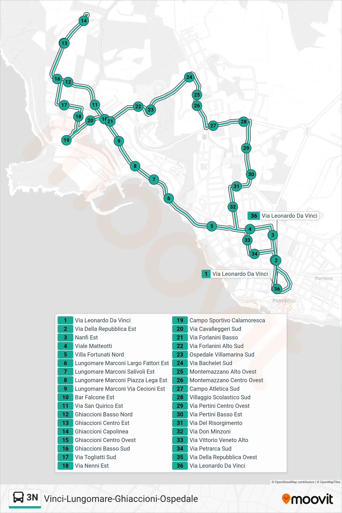
Stops list (3N - Leonardo Da Vinci Street)
- Leonardo Da Vinci Street
- Republic Street East
- East Nanfi
- Matteotti Boulevard
- Villa Fortunati North
- Marconi Seafront Fattori Square East
- Marconi Seafront Salivoli East
- Lungomare Marconi Piazza Lega East
- Marconi Waterfront Cecioni Street East
- Bar Falcone East
- Via San Quirico East
- Lower Ghiaccioni North
- Ghiaccioni Center East
- Ghiaccioni Terminal
- Ghiaccioni Center West
- Lower Ghiaccioni South
- Via Togliatti South
- Nenni Street East
- Calamoresca Sports Field
- South Cavalleggeri Street
- Via Forlanini Lower
- Via Forlanini Upper South
- Villamarina Hospital South
- South Bachelet Street
- Montemazzano High West
- Montemazzano Center West
- South Athletic Field
- South School Village
- Pertini Road West Center
- Via Pertini Lower East
- Risorgimento Street
- Don Minzoni Street
- Upper Vittorio Veneto Street
- Petrarca Street South
- West Republic Road
- Leonardo Da Vinci Street