
4 Bus Route Map
View the 4 route map and see all 4 stops along the route. The map of 4 shows where the bus travels and the location of each stop, making it easy to understand the entire route at a glance.
Explore Transport Board routes on the map and see where Transport Board bus services operate. Use the 4 map to find bus stops and see how the 4 connects different areas along its trip.
All 4 stops on the map are displayed in route order, helping you follow the 4 bus from the first stop to the last.
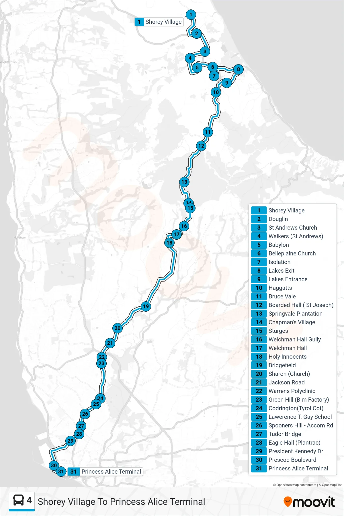
Stops list (4 - Shorey Village To Princess Alice Terminal)
- Shorey Village
- Douglin
- St Andrews Church
- Walkers (St Andrews)
- Babylon
- Belleplaine Church
- Isolation
- Lakes Exit
- Lakes Entrance
- Haggatts
- Bruce Vale
- Boarded Hall ( St Joseph)
- Springvale Plantation
- Chapman's Village
- Sturges
- Welchman Hall Gully
- Welchman Hall
- Holy Innocents
- Bridgefield
- Sharon (Church)
- Jackson Road
- Warrens Polyclinic
- Green Hill (Bim Factory)
- Codrington(Tyrol Cot)
- Lawerence T. Gay School
- Spooners Hill - Accom Rd
- Tudor Bridge
- Eagle Hall (Plantrac)
- President Kennedy Dr
- Prescod Boulevard
- Princess Alice Terminal