
4 Bus Route Map
View the 4 route map and see all 4 stops along the route. The map of 4 shows where the bus travels and the location of each stop, making it easy to understand the entire route at a glance.
Explore ATAF routes on the map and see where ATAF bus services operate. Use the 4 map to find bus stops and see how the 4 connects different areas along its trip.
All 4 stops on the map are displayed in route order, helping you follow the 4 bus from the first stop to the last.
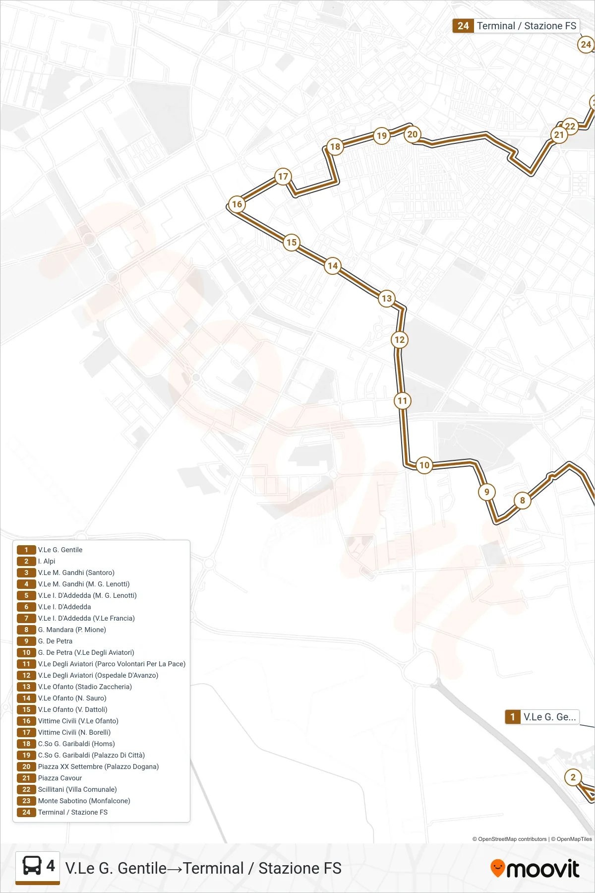
Stops list (4 - G. Gentile Avenue→Terminal / Railway Station)
- G. Gentile Avenue
- I. Alpi
- M. Gandhi Blvd (Santoro)
- M. Gandhi Avenue (M. G. Lenotti)
- I. D'Addedda Avenue (M. G. Lenotti)
- I. D'Addedda Avenue
- I. D'Addedda Avenue (France Avenue)
- G. Mandara (P. Mione)
- G. De Petra
- G. De Petra (Avenue of Aviators)
- Aviators Avenue (Peace Volunteers Park)
- Aviators Avenue (D'Avanzo Hospital)
- Ofanto Boulevard (Zaccheria Stadium)
- Ofanto Avenue (N. Sauro)
- Ofanto Avenue (V. Dattoli)
- Civilian Victims (Ofanto Avenue)
- Civilian Victims (N. Borelli)
- Garibaldi Avenue (Homs)
- G. Garibaldi Avenue (City Hall)
- Piazza XX September (Dogana Palace)
- Cavour Square
- Scillitani (Public Park)
- Monte Sabotino (Monfalcone)
- Terminal / Railway Station