
4 Tram Route Map
View the 4 route map and see all 4 stops along the route. The map of 4 shows where the tram travels and the location of each stop, making it easy to understand the entire route at a glance.
Explore routes on the map and see where tram services operate. Use the 4 map to find tram stations and see how the 4 connects different areas along its trip.
All 4 stops on the map are displayed in route order, helping you follow the 4 tram from the first station to the last.
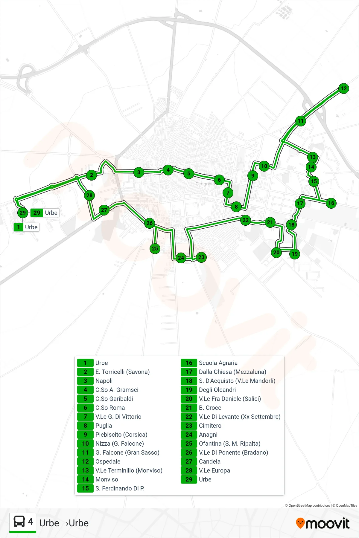
Stops list (4 - City→City)
- City
- E. Torricelli (Savona)
- Naples
- Corso A. Gramsci
- Garibaldi Course
- Roma Course
- G. Di Vittorio Avenue
- Puglia
- Plebiscito (Corsica)
- Nice (G. Falcone)
- G. Falcone (Gran Sasso)
- Hospital
- Viale Terminillo (Monviso)
- Monviso
- San Ferdinando
- Agricultural School
- Dalla Chiesa (Half Moon)
- S. D'Acquisto (Almond Avenue)
- Oleanders
- Fra Daniele Avenue (Willows)
- B. Croce
- Levante Avenue (September XX)
- Cemetery
- Anagni
- Ofantina (Santa Maria Ripalta)
- West Avenue (Bradano)
- Candela
- Europa Avenue
- City