
4 Bus Route Map
View the 4 route map and see all 4 stops along the route. The map of 4 shows where the bus travels and the location of each stop, making it easy to understand the entire route at a glance.
Explore Sydtrafik routes on the map and see where Sydtrafik bus services operate. Use the 4 map to find bus stops and see how the 4 connects different areas along its trip.
All 4 stops on the map are displayed in route order, helping you follow the 4 bus from the first stop to the last.
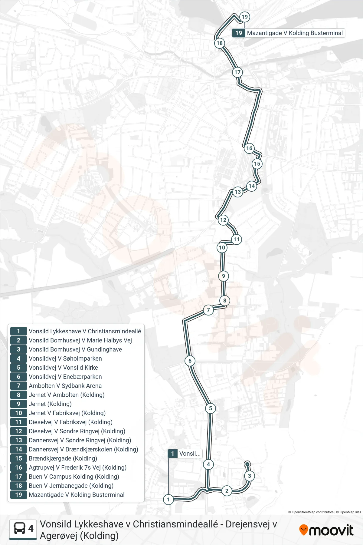
Stops list (4 - Busterminalen)
- Vonsild Lykkeshave V Christiansmindeallé
- Vonsild Bomhusvej V Marie Halbys Vej
- Vonsild Bomhusvej V Gundinghave
- Vonsildvej V Søholmparken
- Vonsildvej V Vonsild Kirke
- Vonsildvej V Enebærparken
- Ambolten V Sydbank Arena
- Jernet V Ambolten (Kolding)
- Jernet (Kolding)
- Jernet V Fabriksvej (Kolding)
- Dieselvej V Fabriksvej (Kolding)
- Dieselvej V Søndre Ringvej (Kolding)
- Dannersvej V Søndre Ringvej (Kolding)
- Dannersvej V Brændkjærskolen (Kolding)
- Brændkjærgade (Kolding)
- Agtrupvej V Frederik 7s Vej (Kolding)
- Buen V Campus Kolding (Kolding)
- Buen V Jernbanegade (Kolding)
- Mazantigade V Kolding Busterminal