
4 Bus Route Map
View the 4 route map and see all 4 stops along the route. The map of 4 shows where the bus travels and the location of each stop, making it easy to understand the entire route at a glance.
Explore The Ride routes on the map and see where The Ride bus services operate. Use the 4 map to find bus stops and see how the 4 connects different areas along its trip.
All 4 stops on the map are displayed in route order, helping you follow the 4 bus from the first stop to the last.
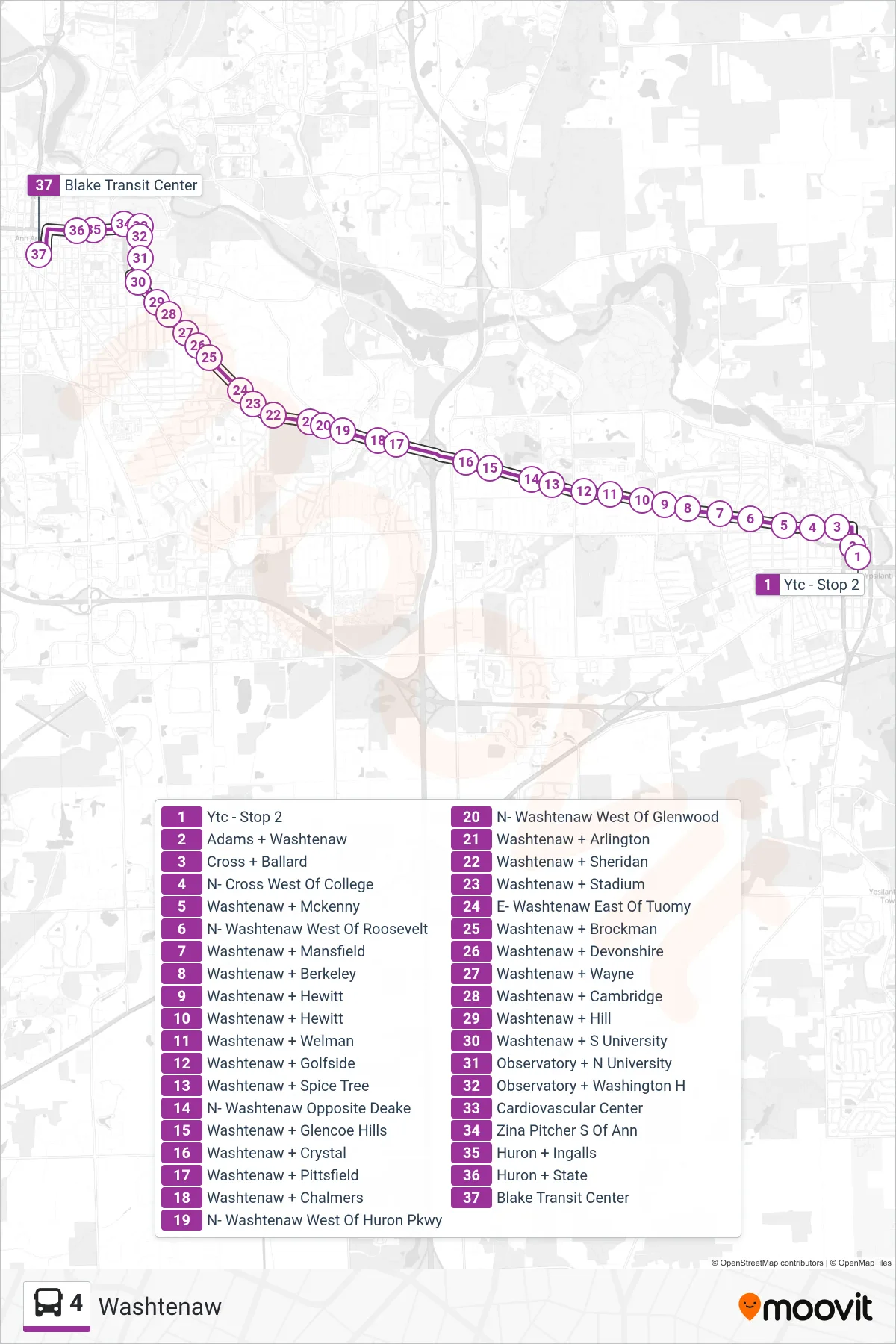
Stops list (4 - Blake Transit Center)
- Ytc - Stop 2
- Adams + Washtenaw
- Cross + Ballard
- N- Cross West Of College
- Washtenaw + Mckenny
- N- Washtenaw West Of Roosevelt
- Washtenaw + Mansfield
- Washtenaw + Berkeley
- Washtenaw + Hewitt
- Washtenaw + Hewitt
- Washtenaw + Welman
- Washtenaw + Golfside
- Washtenaw + Spice Tree
- N- Washtenaw Opposite Deake
- Washtenaw + Glencoe Hills
- Washtenaw + Crystal
- Washtenaw + Pittsfield
- Washtenaw + Chalmers
- N- Washtenaw West Of Huron Pkwy
- N- Washtenaw West Of Glenwood
- Washtenaw + Arlington
- Washtenaw + Sheridan
- Washtenaw + Stadium
- E- Washtenaw East Of Tuomy
- Washtenaw + Brockman
- Washtenaw + Devonshire
- Washtenaw + Wayne
- Washtenaw + Cambridge
- Washtenaw + Hill
- Washtenaw + S University
- Observatory + N University
- Observatory + Washington H
- Cardiovascular Center
- Zina Pitcher S Of Ann
- Huron + Ingalls
- Huron + State
- Blake Transit Center