
4 Bus Route Map
View the 4 route map and see all 4 stops along the route. The map of 4 shows where the bus travels and the location of each stop, making it easy to understand the entire route at a glance.
Explore DDOT routes on the map and see where DDOT bus services operate. Use the 4 map to find bus stops and see how the 4 connects different areas along its trip.
All 4 stops on the map are displayed in route order, helping you follow the 4 bus from the first stop to the last.
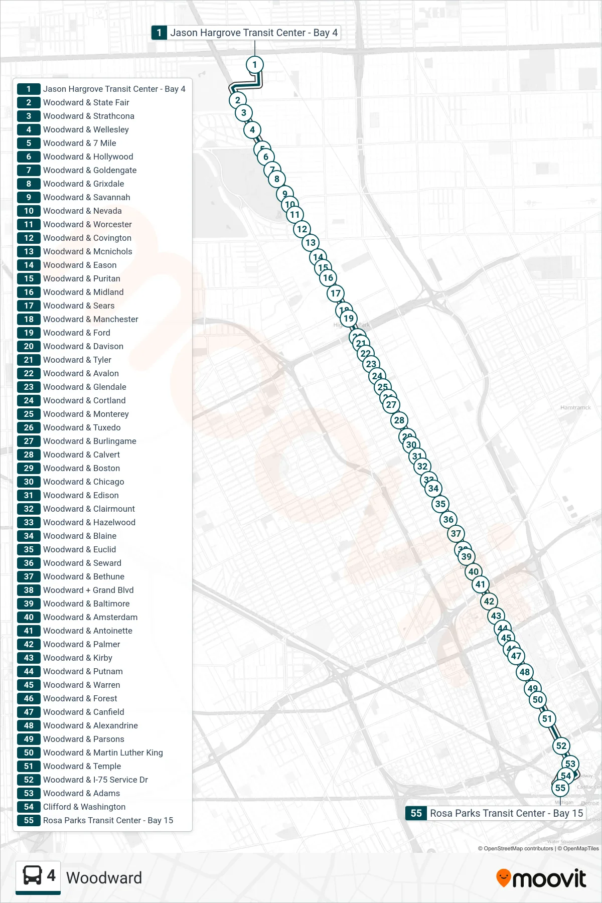
Stops list (4 - Jason Hargrove Transit Center - Bay 4→Rosa Parks Transit Center - Bay 15)
- Jason Hargrove Transit Center - Bay 4
- Woodward & State Fair
- Woodward & Strathcona
- Woodward & Wellesley
- Woodward & 7 Mile
- Woodward & Hollywood
- Woodward & Goldengate
- Woodward & Grixdale
- Woodward & Savannah
- Woodward & Nevada
- Woodward & Worcester
- Woodward & Covington
- Woodward & Mcnichols
- Woodward & Eason
- Woodward & Puritan
- Woodward & Midland
- Woodward & Sears
- Woodward & Manchester
- Woodward & Ford
- Woodward & Davison
- Woodward & Tyler
- Woodward & Avalon
- Woodward & Glendale
- Woodward & Cortland
- Woodward & Monterey
- Woodward & Tuxedo
- Woodward & Burlingame
- Woodward & Calvert
- Woodward & Boston
- Woodward & Chicago
- Woodward & Edison
- Woodward & Clairmount
- Woodward & Hazelwood
- Woodward & Blaine
- Woodward & Euclid
- Woodward & Seward
- Woodward & Bethune
- Woodward + Grand Blvd
- Woodward & Baltimore
- Woodward & Amsterdam
- Woodward & Antoinette
- Woodward & Palmer
- Woodward & Kirby
- Woodward & Putnam
- Woodward & Warren
- Woodward & Forest
- Woodward & Canfield
- Woodward & Alexandrine
- Woodward & Parsons
- Woodward & Martin Luther King
- Woodward & Temple
- Woodward & I-75 Service Dr
- Woodward & Adams
- Clifford & Washington
- Rosa Parks Transit Center - Bay 15