
4 Bus Route Map
View the 4 route map and see all 4 stops along the route. The map of 4 shows where the bus travels and the location of each stop, making it easy to understand the entire route at a glance.
Explore FARGO routes on the map and see where FARGO bus services operate. Use the 4 map to find bus stops and see how the 4 connects different areas along its trip.
All 4 stops on the map are displayed in route order, helping you follow the 4 bus from the first stop to the last.
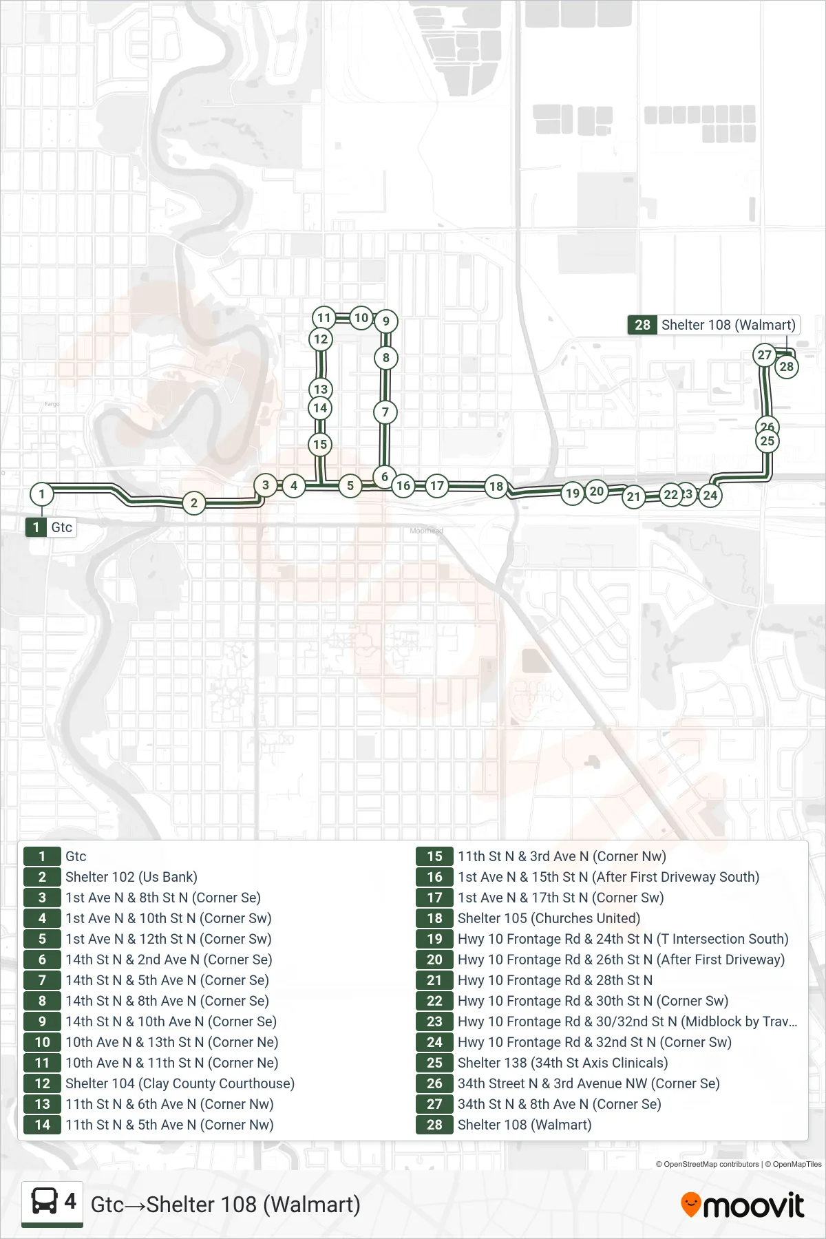
Stops list (4 - Gtc→Shelter 108 (Walmart))
- Gtc
- Shelter 102 (Us Bank)
- 1st Ave N & 8th St N (Corner Se)
- 1st Ave N & 10th St N (Corner Sw)
- 1st Ave N & 12th St N (Corner Sw)
- 14th St N & 2nd Ave N (Corner Se)
- 14th St N & 5th Ave N (Corner Se)
- 14th St N & 8th Ave N (Corner Se)
- 14th St N & 10th Ave N (Corner Se)
- 10th Ave N & 13th St N (Corner Ne)
- 10th Ave N & 11th St N (Corner Ne)
- Shelter 104 (Clay County Courthouse)
- 11th St N & 6th Ave N (Corner Nw)
- 11th St N & 5th Ave N (Corner Nw)
- 11th St N & 3rd Ave N (Corner Nw)
- 1st Ave N & 15th St N (After First Driveway South)
- 1st Ave N & 17th St N (Corner Sw)
- Shelter 105 (Churches United)
- Hwy 10 Frontage Rd & 24th St N (T Intersection South)
- Hwy 10 Frontage Rd & 26th St N (After First Driveway)
- Hwy 10 Frontage Rd & 28th St N
- Hwy 10 Frontage Rd & 30th St N (Corner Sw)
- Hwy 10 Frontage Rd & 30/32nd St N (Midblock by Travelodge Driveway)
- Hwy 10 Frontage Rd & 32nd St N (Corner Sw)
- Shelter 138 (34th St Axis Clinicals)
- 34th Street N & 3rd Avenue NW (Corner Se)
- 34th St N & 8th Ave N (Corner Se)
- Shelter 108 (Walmart)