
4+ Bus Route Map
View the 4+ route map and see all 4+ stops along the route. The map of 4+ shows where the bus travels and the location of each stop, making it easy to understand the entire route at a glance.
Explore Livorno and Province - Tuscan Bus Lines routes on the map and see where Livorno and Province - Tuscan Bus Lines bus services operate. Use the 4+ map to find bus stops and see how the 4+ connects different areas along its trip.
All 4+ stops on the map are displayed in route order, helping you follow the 4+ bus from the first stop to the last.
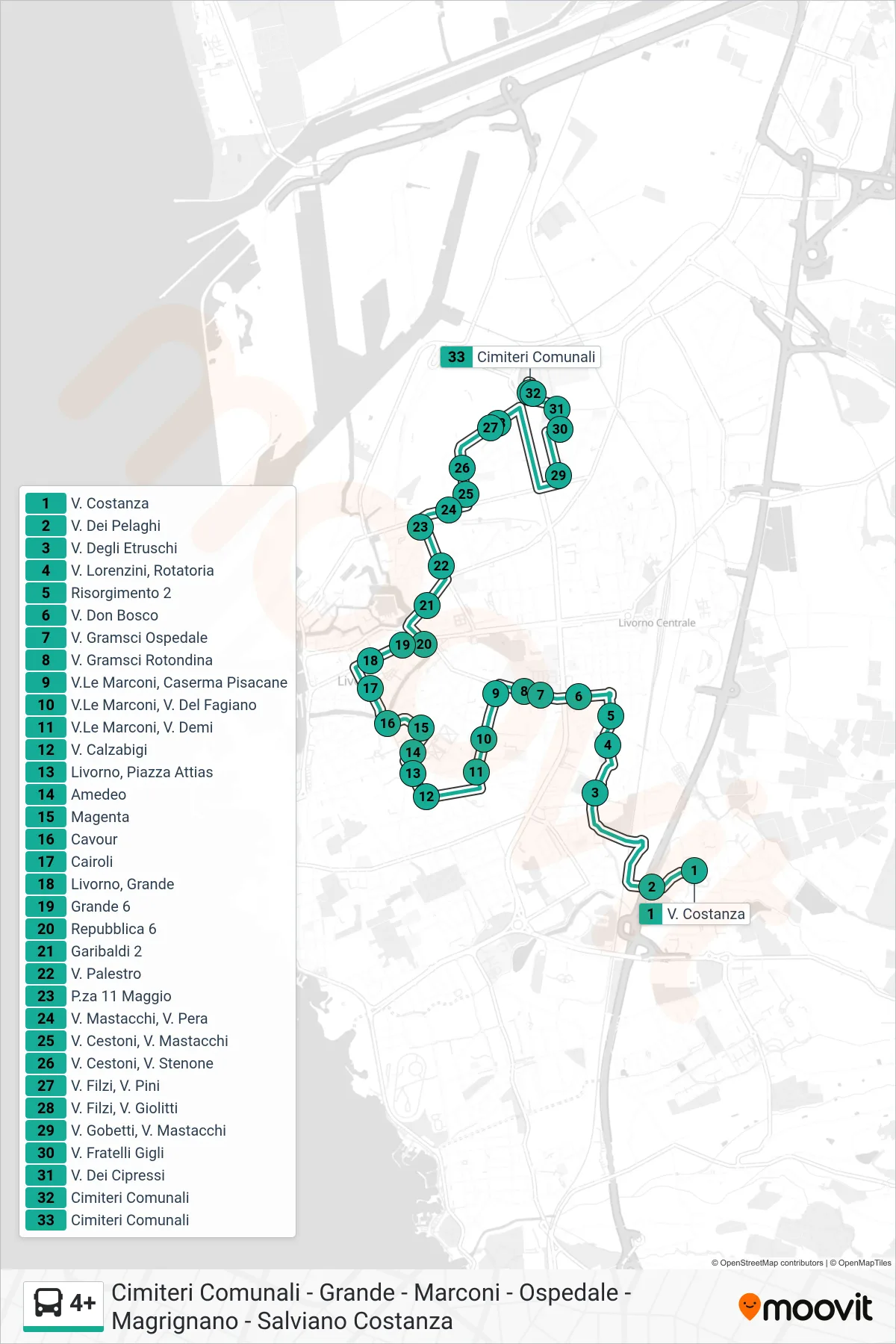
Stops list (4+ - Municipal Cemeteries)
- Via Costanza
- Via Dei Pelaghi
- Etruscan Street
- Via Lorenzini, Roundabout
- Risorgimento 2
- Don Bosco Road
- Gramsci Hospital Road
- Gramsci Street Rotondina
- Marconi Ave, Pisacane Barracks
- Marconi Ave, Fagiano Road
- Marconi Avenue, Via Demi
- Calzabigi Street
- Livorno, Attias Square
- Amedeo
- Magenta
- Cavour
- Cairoli
- Livorno, Grande
- Grande 6
- Repubblica 6
- Garibaldi 2
- Via Palestro
- May 11 Square
- Mastacchi St, Pera St
- Cestoni St, Mastacchi St
- Cestoni St, Stenone St
- Filzi St, Pini St
- Filzi St, Giolitti St
- Gobetti Street, Mastacchi Street
- Fratelli Gigli Street
- Cypress Street
- Municipal Cemeteries
- Municipal Cemeteries