
4 Bus Route Map
View the 4 route map and see all 4 stops along the route. The map of 4 shows where the bus travels and the location of each stop, making it easy to understand the entire route at a glance.
Explore Capital Transit routes on the map and see where Capital Transit bus services operate. Use the 4 map to find bus stops and see how the 4 connects different areas along its trip.
All 4 stops on the map are displayed in route order, helping you follow the 4 bus from the first stop to the last.
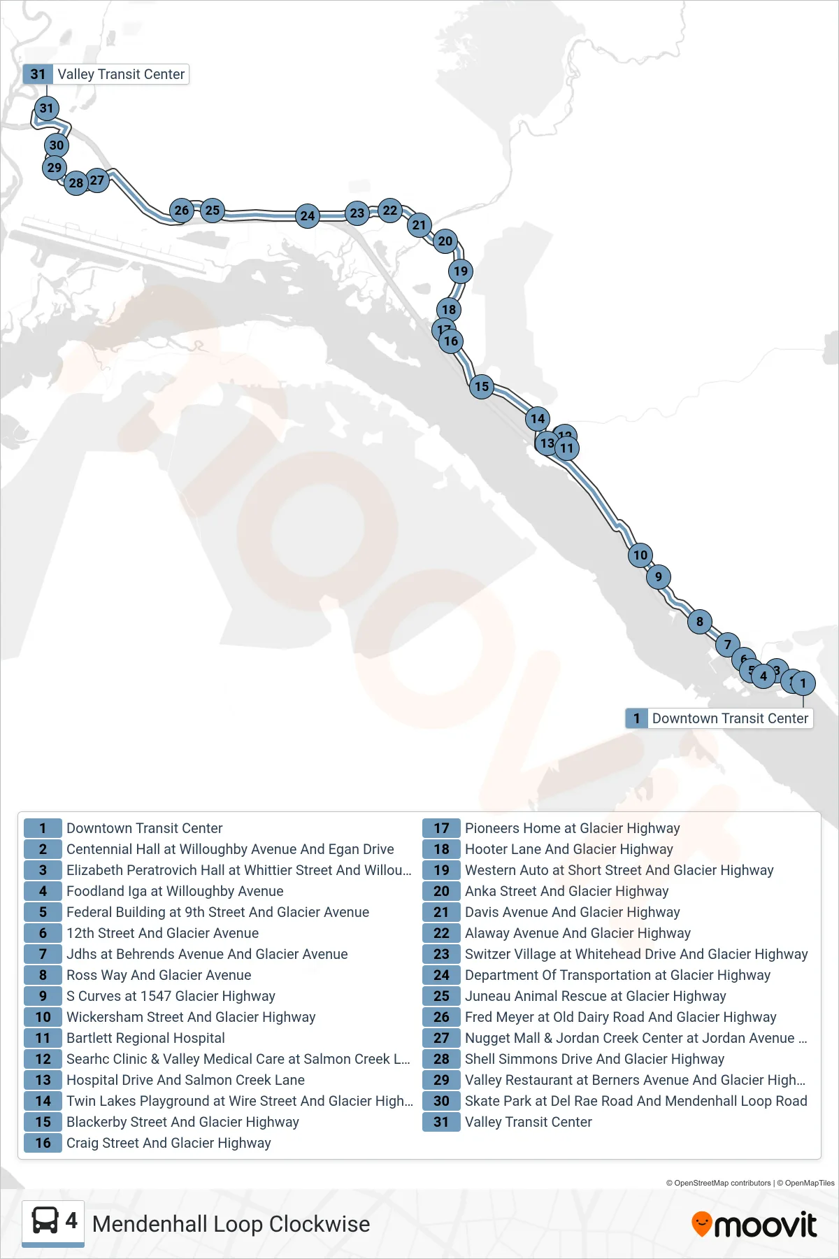
Stops list (4 - Downtown Transit Center→Valley Transit Center Bay 3)
- Downtown Transit Center
- Centennial Hall at Willoughby Avenue And Egan Drive
- Elizabeth Peratrovich Hall at Whittier Street And Willoughby Avenue
- Foodland Iga at Willoughby Avenue
- Federal Building at 9th Street And Glacier Avenue
- 12th Street And Glacier Avenue
- Jdhs at Behrends Avenue And Glacier Avenue
- Ross Way And Glacier Avenue
- S Curves at 1547 Glacier Highway
- Wickersham Street And Glacier Highway
- Bartlett Regional Hospital
- Searhc Clinic & Valley Medical Care at Salmon Creek Lane
- Hospital Drive And Salmon Creek Lane
- Twin Lakes Playground at Wire Street And Glacier Highway
- Blackerby Street And Glacier Highway
- Craig Street And Glacier Highway
- Pioneers Home at Glacier Highway
- Hooter Lane And Glacier Highway
- Western Auto at Short Street And Glacier Highway
- Anka Street And Glacier Highway
- Davis Avenue And Glacier Highway
- Alaway Avenue And Glacier Highway
- Switzer Village at Whitehead Drive And Glacier Highway
- Department Of Transportation at Glacier Highway
- Juneau Animal Rescue at Glacier Highway
- Fred Meyer at Old Dairy Road And Glacier Highway
- Nugget Mall & Jordan Creek Center at Jordan Avenue And Glacier Highway
- Shell Simmons Drive And Glacier Highway
- Valley Restaurant at Berners Avenue And Glacier Highway
- Skate Park at Del Rae Road And Mendenhall Loop Road
- Valley Transit Center