
4 Bus Route Map
View the 4 route map and see all 4 stops along the route. The map of 4 shows where the bus travels and the location of each stop, making it easy to understand the entire route at a glance.
Explore Stadtwerke Trier routes on the map and see where Stadtwerke Trier bus services operate. Use the 4 map to find bus stops and see how the 4 connects different areas along its trip.
All 4 stops on the map are displayed in route order, helping you follow the 4 bus from the first stop to the last.
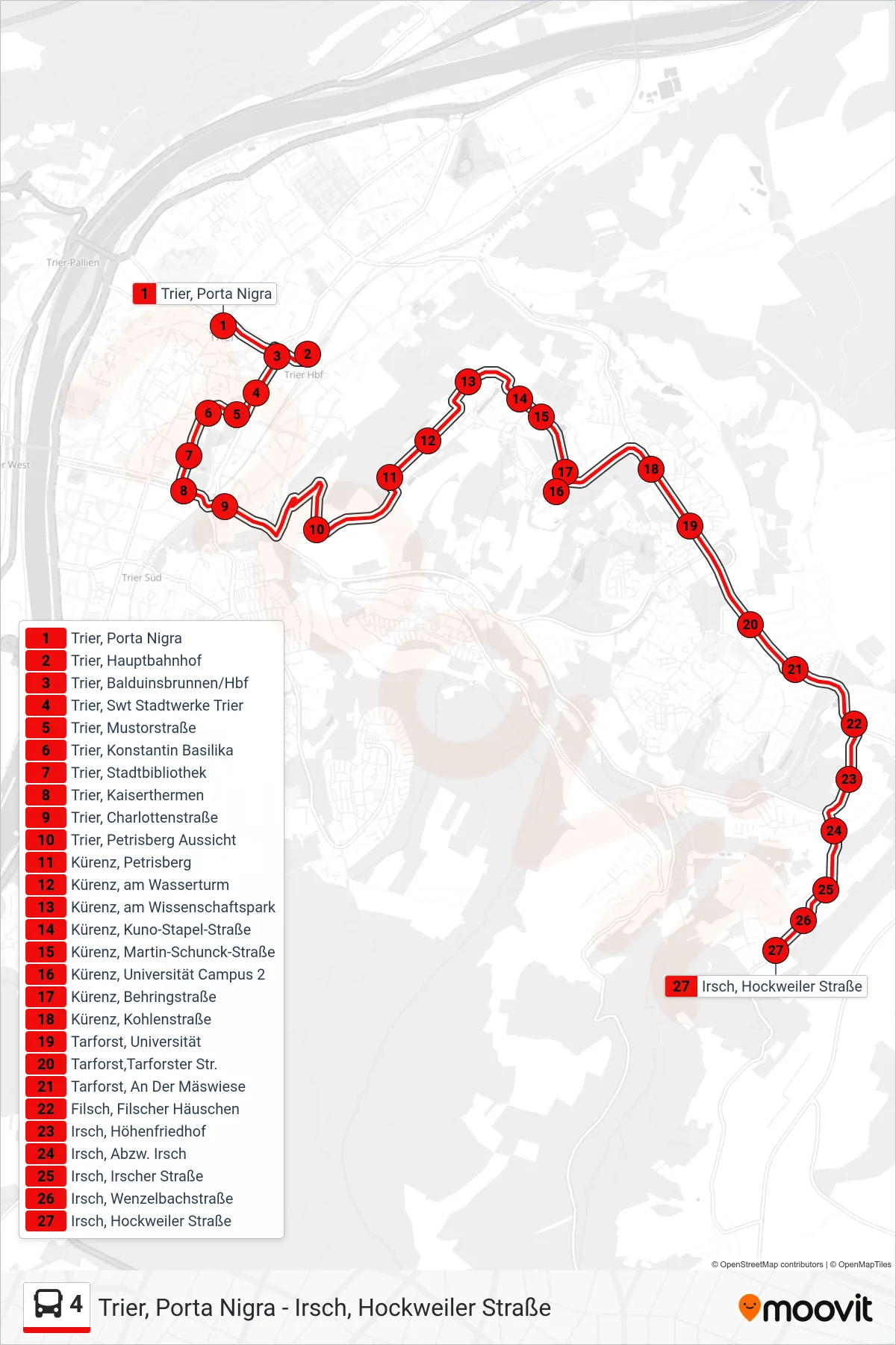
Stops list (4 - Irsch, Hockweiler Straße)
- Trier, Porta Nigra
- Trier, Hauptbahnhof
- Trier, Balduinsbrunnen/Hbf
- Trier, Swt Stadtwerke Trier
- Trier, Mustorstraße
- Trier, Konstantin Basilika
- Trier, Stadtbibliothek
- Trier, Kaiserthermen
- Trier, Charlottenstraße
- Trier, Petrisberg Aussicht
- Kürenz, Petrisberg
- Kürenz, am Wasserturm
- Kürenz, am Wissenschaftspark
- Kürenz, Kuno-Stapel-Straße
- Kürenz, Martin-Schunck-Straße
- Kürenz, Universität Campus 2
- Kürenz, Behringstraße
- Kürenz, Kohlenstraße
- Tarforst, Universität
- Tarforst,Tarforster Str.
- Tarforst, An Der Mäswiese
- Filsch, Filscher Häuschen
- Irsch, Höhenfriedhof
- Irsch, Abzw. Irsch
- Irsch, Irscher Straße
- Irsch, Wenzelbachstraße
- Irsch, Hockweiler Straße