
4 Bus Route Map
View the 4 route map and see all 4 stops along the route. The map of 4 shows where the bus travels and the location of each stop, making it easy to understand the entire route at a glance.
Explore Bus8 routes on the map and see where Bus8 bus services operate. Use the 4 map to find bus stops and see how the 4 connects different areas along its trip.
All 4 stops on the map are displayed in route order, helping you follow the 4 bus from the first stop to the last.
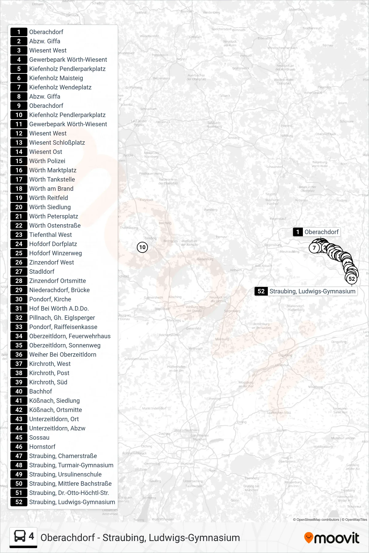
Stops list (4 - Straubing)
- Oberachdorf
- Abzw. Giffa
- Wiesent West
- Gewerbepark Wörth-Wiesent
- Kiefenholz Pendlerparkplatz
- Kiefenholz Maisteig
- Kiefenholz Wendeplatz
- Abzw. Giffa
- Oberachdorf
- Kiefenholz Pendlerparkplatz
- Gewerbepark Wörth-Wiesent
- Wiesent West
- Wiesent Schloßplatz
- Wiesent Ost
- Wörth Polizei
- Wörth Marktplatz
- Wörth Tankstelle
- Wörth am Brand
- Wörth Reitfeld
- Wörth Siedlung
- Wörth Petersplatz
- Wörth Ostenstraße
- Tiefenthal West
- Hofdorf Dorfplatz
- Hofdorf Winzerweg
- Zinzendorf West
- Stadldorf
- Zinzendorf Ortsmitte
- Niederachdorf, Brücke
- Pondorf, Kirche
- Hof Bei Wörth A.D.Do.
- Pillnach, Gh. Eiglsperger
- Pondorf, Raiffeisenkasse
- Oberzeitldorn, Feuerwehrhaus
- Oberzeitldorn, Sonnenweg
- Weiher Bei Oberzeitldorn
- Kirchroth, West
- Kirchroth, Post
- Kirchroth, Süd
- Bachhof
- Kößnach, Siedlung
- Kößnach, Ortsmitte
- Unterzeitldorn, Ort
- Unterzeitldorn, Abzw
- Sossau
- Hornstorf
- Straubing, Chamerstraße
- Straubing, Turmair-Gymnasium
- Straubing, Ursulinenschule
- Straubing, Mittlere Bachstraße
- Straubing, Dr.-Otto-Höchtl-Str.
- Straubing, Ludwigs-Gymnasium