
4 Bus Route Map
View the 4 route map and see all 4 stops along the route. The map of 4 shows where the bus travels and the location of each stop, making it easy to understand the entire route at a glance.
Explore Bus8 routes on the map and see where Bus8 bus services operate. Use the 4 map to find bus stops and see how the 4 connects different areas along its trip.
All 4 stops on the map are displayed in route order, helping you follow the 4 bus from the first stop to the last.
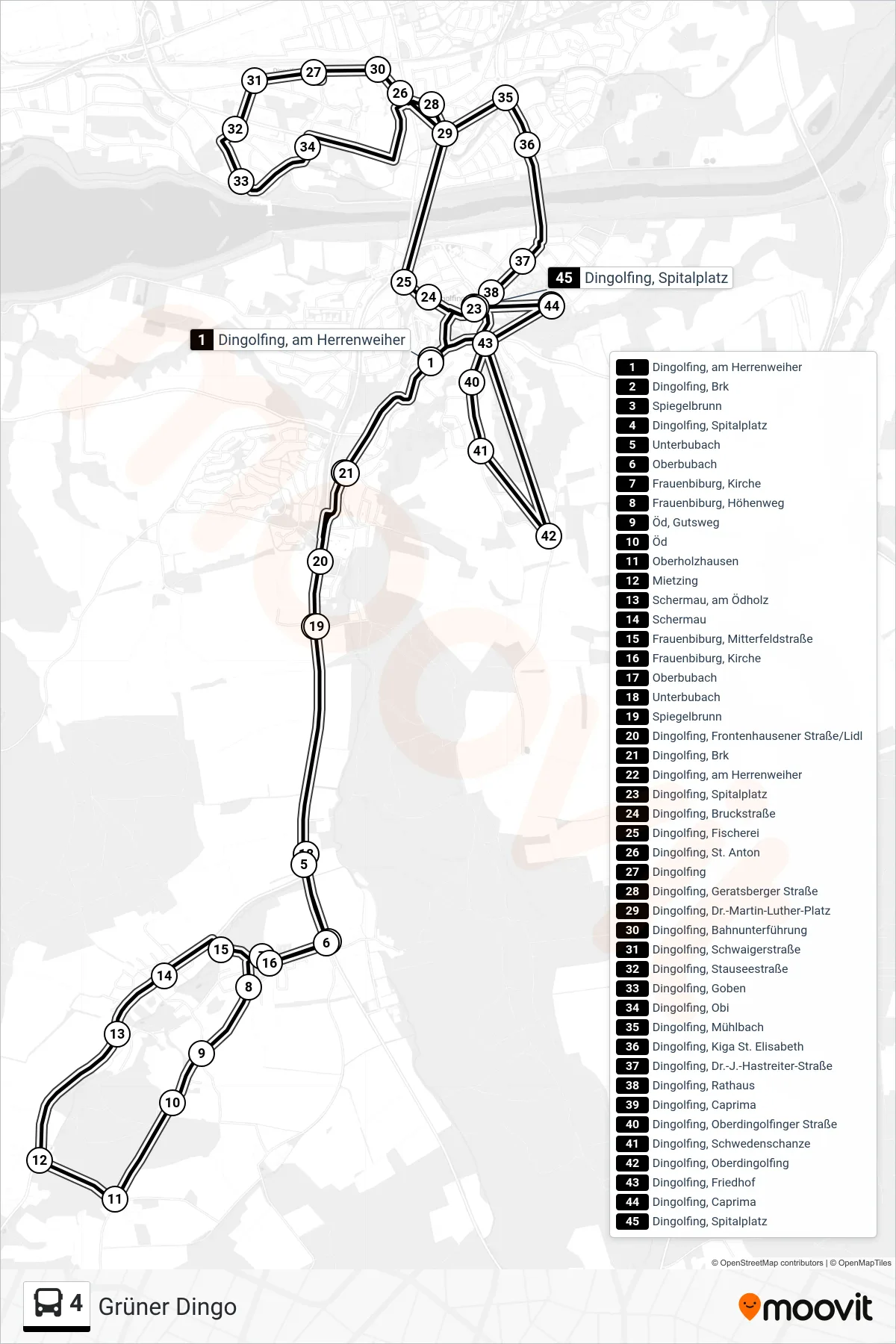
Stops list (4 - Grüner Dingo)
- Dingolfing, am Herrenweiher
- Dingolfing, Brk
- Spiegelbrunn
- Dingolfing, Spitalplatz
- Unterbubach
- Oberbubach
- Frauenbiburg, Kirche
- Frauenbiburg, Höhenweg
- Öd, Gutsweg
- Öd
- Oberholzhausen
- Mietzing
- Schermau, am Ödholz
- Schermau
- Frauenbiburg, Mitterfeldstraße
- Frauenbiburg, Kirche
- Oberbubach
- Unterbubach
- Spiegelbrunn
- Dingolfing, Frontenhausener Straße/Lidl
- Dingolfing, Brk
- Dingolfing, am Herrenweiher
- Dingolfing, Spitalplatz
- Dingolfing, Bruckstraße
- Dingolfing, Fischerei
- Dingolfing, St. Anton
- Dingolfing
- Dingolfing, Geratsberger Straße
- Dingolfing, Dr.-Martin-Luther-Platz
- Dingolfing, Bahnunterführung
- Dingolfing, Schwaigerstraße
- Dingolfing, Stauseestraße
- Dingolfing, Goben
- Dingolfing, Obi
- Dingolfing, Mühlbach
- Dingolfing, Kiga St. Elisabeth
- Dingolfing, Dr.-J.-Hastreiter-Straße
- Dingolfing, Rathaus
- Dingolfing, Caprima
- Dingolfing, Oberdingolfinger Straße
- Dingolfing, Schwedenschanze
- Dingolfing, Oberdingolfing
- Dingolfing, Friedhof
- Dingolfing, Caprima
- Dingolfing, Spitalplatz