
4 Bus Route Map
View the 4 route map and see all 4 stops along the route. The map of 4 shows where the bus travels and the location of each stop, making it easy to understand the entire route at a glance.
Explore De Lijn routes on the map and see where De Lijn bus services operate. Use the 4 map to find bus stops and see how the 4 connects different areas along its trip.
All 4 stops on the map are displayed in route order, helping you follow the 4 bus from the first stop to the last.
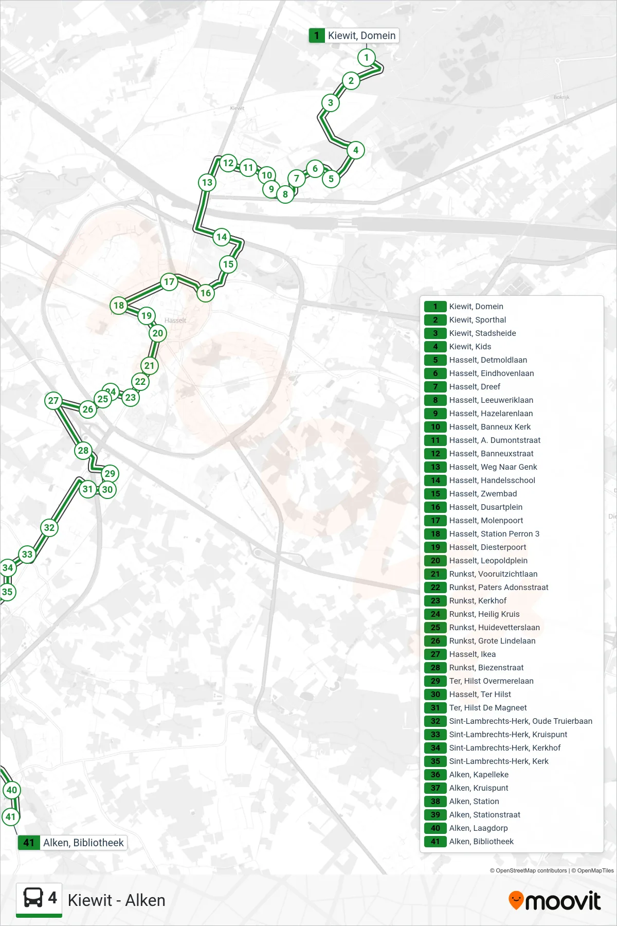
Stops list (4 - Alken Bibliotheek)
- Kiewit, Domein
- Kiewit, Sporthal
- Kiewit, Stadsheide
- Kiewit, Kids
- Hasselt, Detmoldlaan
- Hasselt, Eindhovenlaan
- Hasselt, Dreef
- Hasselt, Leeuweriklaan
- Hasselt, Hazelarenlaan
- Hasselt, Banneux Kerk
- Hasselt, A. Dumontstraat
- Hasselt, Banneuxstraat
- Hasselt, Weg Naar Genk
- Hasselt, Handelsschool
- Hasselt, Zwembad
- Hasselt, Dusartplein
- Hasselt, Molenpoort
- Hasselt, Station Perron 3
- Hasselt, Diesterpoort
- Hasselt, Leopoldplein
- Runkst, Vooruitzichtlaan
- Runkst, Paters Adonsstraat
- Runkst, Kerkhof
- Runkst, Heilig Kruis
- Runkst, Huidevetterslaan
- Runkst, Grote Lindelaan
- Hasselt, Ikea
- Runkst, Biezenstraat
- Ter, Hilst Overmerelaan
- Hasselt, Ter Hilst
- Ter, Hilst De Magneet
- Sint-Lambrechts-Herk, Oude Truierbaan
- Sint-Lambrechts-Herk, Kruispunt
- Sint-Lambrechts-Herk, Kerkhof
- Sint-Lambrechts-Herk, Kerk
- Alken, Kapelleke
- Alken, Kruispunt
- Alken, Station
- Alken, Stationstraat
- Alken, Laagdorp
- Alken, Bibliotheek