
4 Light Rail Route Map
View the 4 route map and see all 4 stops along the route. The map of 4 shows where the light rail travels and the location of each stop, making it easy to understand the entire route at a glance.
Explore HTM routes on the map and see where HTM light rail services operate. Use the 4 map to find light rail stations and see how the 4 connects different areas along its trip.
All 4 stops on the map are displayed in route order, helping you follow the 4 light rail from the first station to the last.
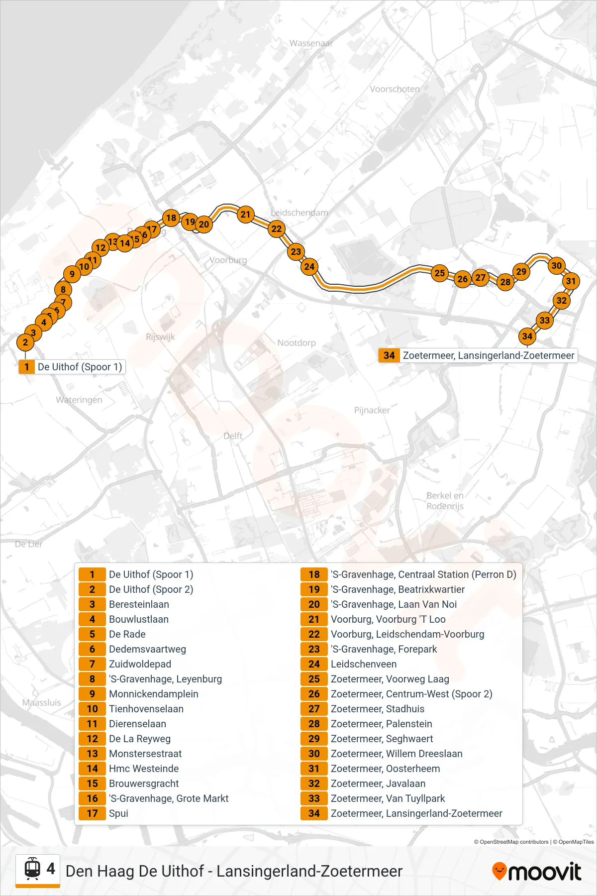
Stops list (4 - Den Haag De Uithof)
- De Uithof (Spoor 1)
- De Uithof (Spoor 2)
- Beresteinlaan
- Bouwlustlaan
- De Rade
- Dedemsvaartweg
- Zuidwoldepad
- 'S-Gravenhage, Leyenburg
- Monnickendamplein
- Tienhovenselaan
- Dierenselaan
- De La Reyweg
- Monstersestraat
- Hmc Westeinde
- Brouwersgracht
- 'S-Gravenhage, Grote Markt
- Spui
- 'S-Gravenhage, Centraal Station (Perron D)
- 'S-Gravenhage, Beatrixkwartier
- 'S-Gravenhage, Laan Van Noi
- Voorburg, Voorburg 'T Loo
- Voorburg, Leidschendam-Voorburg
- 'S-Gravenhage, Forepark
- Leidschenveen
- Zoetermeer, Voorweg Laag
- Zoetermeer, Centrum-West (Spoor 2)
- Zoetermeer, Stadhuis
- Zoetermeer, Palenstein
- Zoetermeer, Seghwaert
- Zoetermeer, Willem Dreeslaan
- Zoetermeer, Oosterheem
- Zoetermeer, Javalaan
- Zoetermeer, Van Tuyllpark
- Zoetermeer, Lansingerland-Zoetermeer