
4 Bus Route Map
View the 4 route map and see all 4 stops along the route. The map of 4 shows where the bus travels and the location of each stop, making it easy to understand the entire route at a glance.
Explore Yamhill County Transit Area routes on the map and see where Yamhill County Transit Area bus services operate. Use the 4 map to find bus stops and see how the 4 connects different areas along its trip.
All 4 stops on the map are displayed in route order, helping you follow the 4 bus from the first stop to the last.
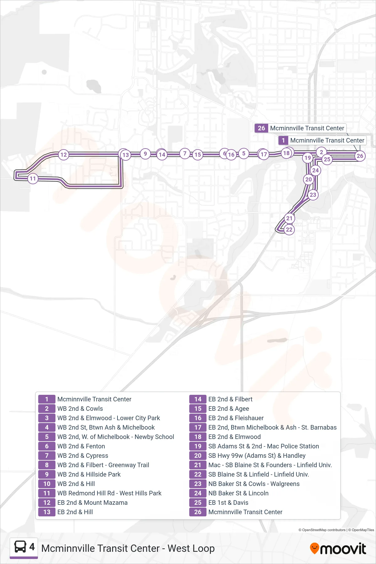
Stops list (4 - Mcminnville Transit Center - West Loop)
- Mcminnville Transit Center
- WB 2nd & Cowls
- WB 2nd & Elmwood - Lower City Park
- WB 2nd St, Btwn Ash & Michelbook
- WB 2nd, W. of Michelbook - Newby School
- WB 2nd & Fenton
- WB 2nd & Cypress
- WB 2nd & Filbert - Greenway Trail
- WB 2nd & Hillside Park
- WB 2nd & Hill
- WB Redmond Hill Rd - West Hills Park
- EB 2nd & Mount Mazama
- EB 2nd & Hill
- EB 2nd & Filbert
- EB 2nd & Agee
- EB 2nd & Fleishauer
- EB 2nd, Btwn Michelbook & Ash - St. Barnabas
- EB 2nd & Elmwood
- SB Adams St & 2nd - Mac Police Station
- SB Hwy 99w (Adams St) & Handley
- Mac - SB Blaine St & Founders - Linfield Univ.
- SB Blaine St & Linfield - Linfield Univ.
- NB Baker St & Cowls - Walgreens
- NB Baker St & Lincoln
- EB 1st & Davis
- Mcminnville Transit Center