
4 Cable Car Route Map
View the 4 route map and see all 4 stops along the route. The map of 4 shows where the cable car travels and the location of each stop, making it easy to understand the entire route at a glance.
Explore Rīgas satiksme routes on the map and see where Rīgas satiksme cable car services operate. Use the 4 map to find cable car stations and see how the 4 connects different areas along its trip.
All 4 stops on the map are displayed in route order, helping you follow the 4 cable car from the first station to the last.
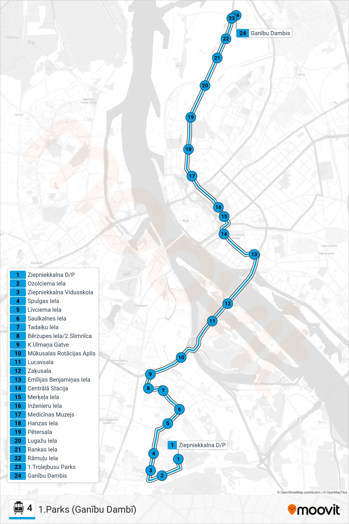
Stops list (4 - 1.Parks (Ganību Dambī))
- Ziepniekkalna D/P
- Ozolciema Iela
- Ziepniekkalna Vidusskola
- Spulgas Iela
- Līvciema Iela
- Saulkalnes Iela
- Tadaiķu Iela
- Bērzupes Iela/2.Slimnīca
- K.Ulmaņa Gatve
- Mūkusalas Rotācijas Aplis
- Lucavsala
- Zaķusala
- Emīlijas Benjamiņas Iela
- Centrālā Stacija
- Merķeļa Iela
- Inženieru Iela
- Medicīnas Muzejs
- Hanzas Iela
- Pētersala
- Lugažu Iela
- Rankas Iela
- Rāmuļu Iela
- 1.Trolejbusu Parks
- Ganību Dambis