
4 Bus Route Map
View the 4 route map and see all 4 stops along the route. The map of 4 shows where the bus travels and the location of each stop, making it easy to understand the entire route at a glance.
Explore Rīgas satiksme routes on the map and see where Rīgas satiksme bus services operate. Use the 4 map to find bus stops and see how the 4 connects different areas along its trip.
All 4 stops on the map are displayed in route order, helping you follow the 4 bus from the first stop to the last.
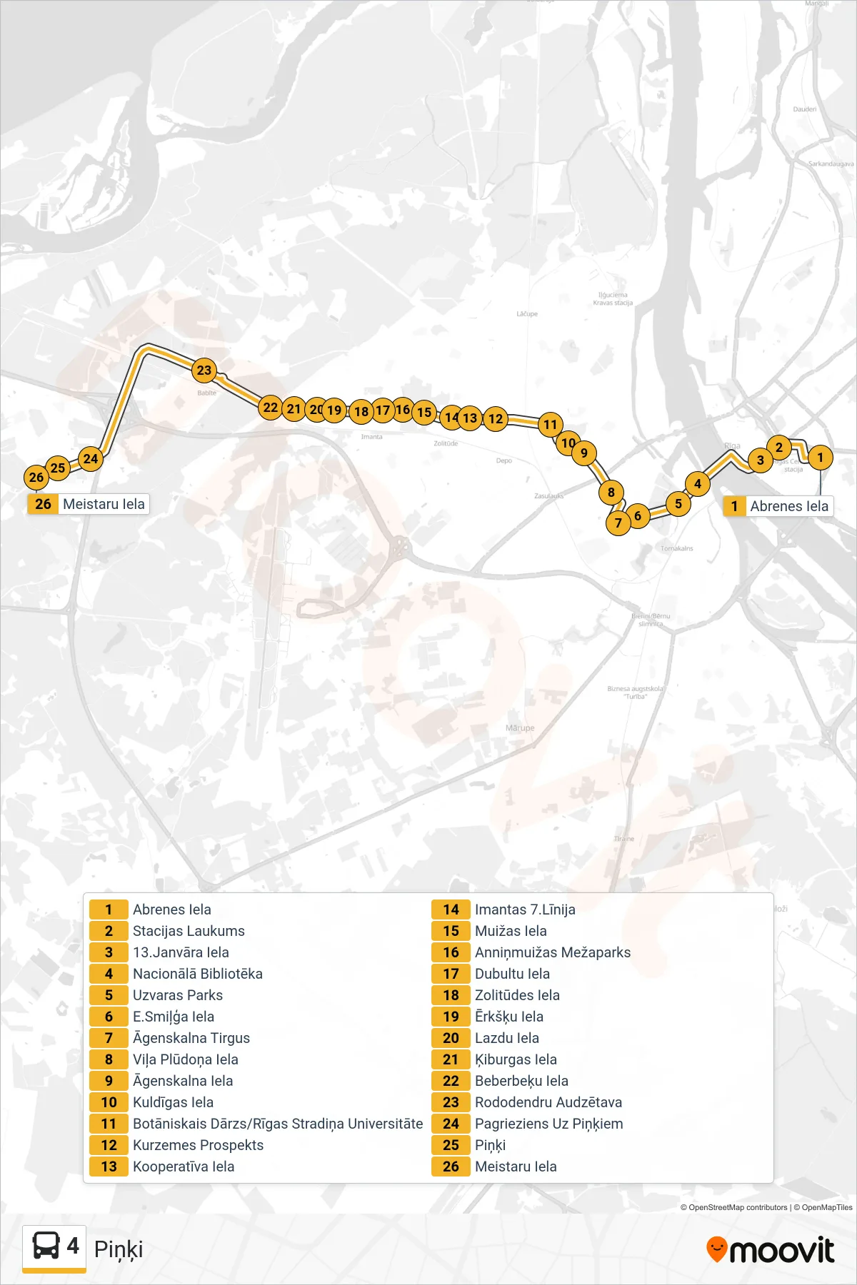
Stops list (4 - Piņķi)
- Abrenes Iela
- Stacijas Laukums
- 13.Janvāra Iela
- Nacionālā Bibliotēka
- Uzvaras Parks
- E.Smiļģa Iela
- Āgenskalna Tirgus
- Viļa Plūdoņa Iela
- Āgenskalna Iela
- Kuldīgas Iela
- Botāniskais Dārzs/Rīgas Stradiņa Universitāte
- Kurzemes Prospekts
- Kooperatīva Iela
- Imantas 7.Līnija
- Muižas Iela
- Anniņmuižas Mežaparks
- Dubultu Iela
- Zolitūdes Iela
- Ērkšķu Iela
- Lazdu Iela
- Ķiburgas Iela
- Beberbeķu Iela
- Rododendru Audzētava
- Pagrieziens Uz Piņķiem
- Piņķi
- Meistaru Iela