
4 Bus Route Map
View the 4 route map and see all 4 stops along the route. The map of 4 shows where the bus travels and the location of each stop, making it easy to understand the entire route at a glance.
Explore Redding Area Bus Authority (Shasta County) routes on the map and see where Redding Area Bus Authority (Shasta County) bus services operate. Use the 4 map to find bus stops and see how the 4 connects different areas along its trip.
All 4 stops on the map are displayed in route order, helping you follow the 4 bus from the first stop to the last.
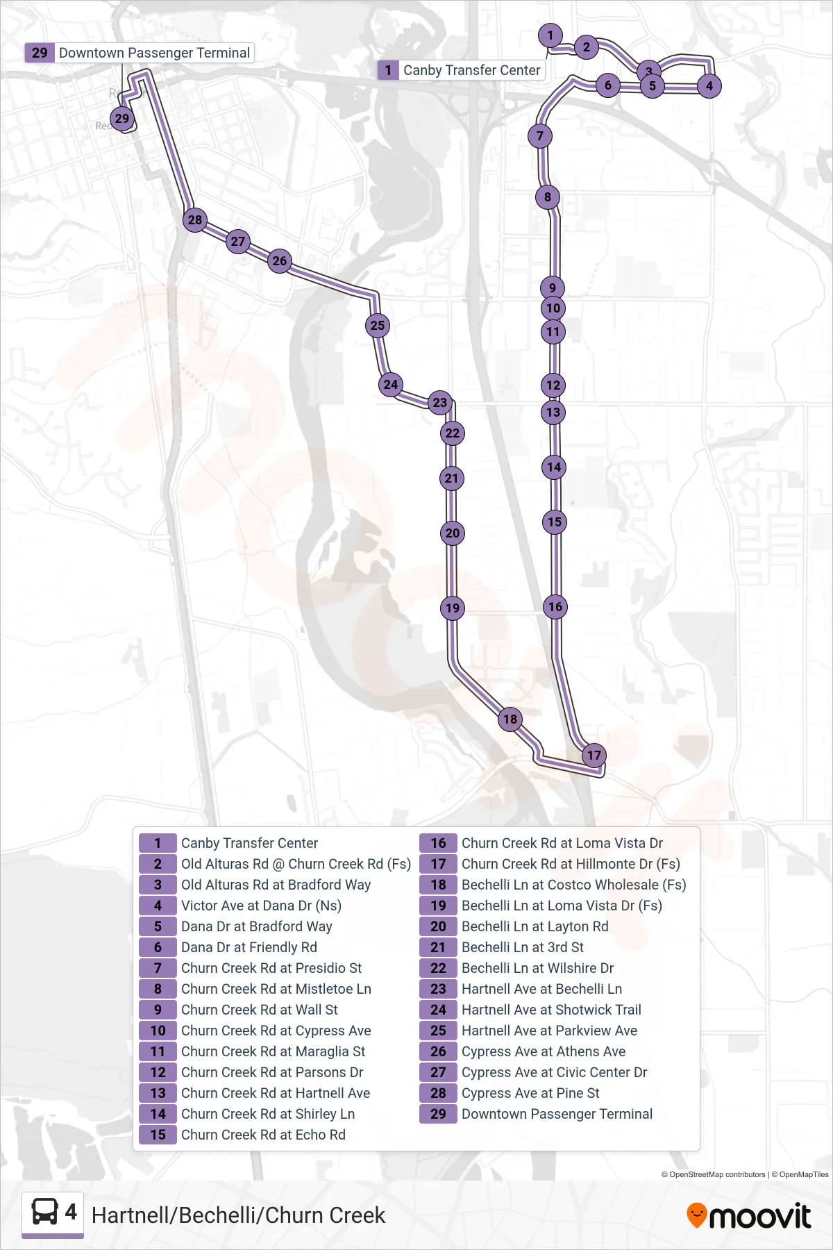
Stops list (4 - Hartnell/Bechelli/Churn Creek)
- Canby Transfer Center
- Old Alturas Rd @ Churn Creek Rd (Fs)
- Old Alturas Rd at Bradford Way
- Victor Ave at Dana Dr (Ns)
- Dana Dr at Bradford Way
- Dana Dr at Friendly Rd
- Churn Creek Rd at Presidio St
- Churn Creek Rd at Mistletoe Ln
- Churn Creek Rd at Wall St
- Churn Creek Rd at Cypress Ave
- Churn Creek Rd at Maraglia St
- Churn Creek Rd at Parsons Dr
- Churn Creek Rd at Hartnell Ave
- Churn Creek Rd at Shirley Ln
- Churn Creek Rd at Echo Rd
- Churn Creek Rd at Loma Vista Dr
- Churn Creek Rd at Hillmonte Dr (Fs)
- Bechelli Ln at Costco Wholesale (Fs)
- Bechelli Ln at Loma Vista Dr (Fs)
- Bechelli Ln at Layton Rd
- Bechelli Ln at 3rd St
- Bechelli Ln at Wilshire Dr
- Hartnell Ave at Bechelli Ln
- Hartnell Ave at Shotwick Trail
- Hartnell Ave at Parkview Ave
- Cypress Ave at Athens Ave
- Cypress Ave at Civic Center Dr
- Cypress Ave at Pine St
- Downtown Passenger Terminal