
4 Bus Route Map
View the 4 route map and see all 4 stops along the route. The map of 4 shows where the bus travels and the location of each stop, making it easy to understand the entire route at a glance.
Explore Aachener Straßenbahn- und Energieversorgungs-AG routes on the map and see where Aachener Straßenbahn- und Energieversorgungs-AG bus services operate. Use the 4 map to find bus stops and see how the 4 connects different areas along its trip.
All 4 stops on the map are displayed in route order, helping you follow the 4 bus from the first stop to the last.
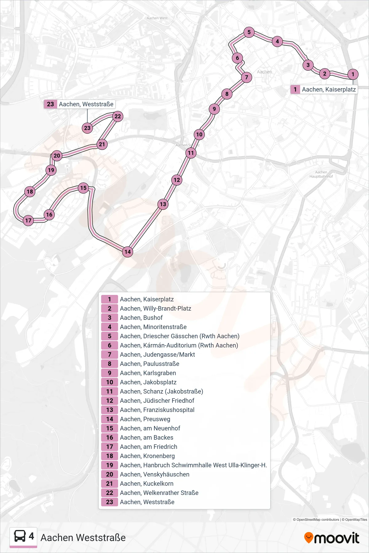
Stops list (4 - Aachen Weststraße)
- Aachen, Kaiserplatz
- Aachen, Willy-Brandt-Platz
- Aachen, Bushof
- Aachen, Minoritenstraße
- Aachen, Driescher Gässchen (Rwth Aachen)
- Aachen, Kármán-Auditorium (Rwth Aachen)
- Aachen, Judengasse/Markt
- Aachen, Paulusstraße
- Aachen, Karlsgraben
- Aachen, Jakobsplatz
- Aachen, Schanz (Jakobstraße)
- Aachen, Jüdischer Friedhof
- Aachen, Franziskushospital
- Aachen, Preusweg
- Aachen, am Neuenhof
- Aachen, am Backes
- Aachen, am Friedrich
- Aachen, Kronenberg
- Aachen, Hanbruch Schwimmhalle West Ulla-Klinger-H.
- Aachen, Venskyhäuschen
- Aachen, Kuckelkorn
- Aachen, Welkenrather Straße
- Aachen, Weststraße