
4 Bus Route Map
View the 4 route map and see all 4 stops along the route. The map of 4 shows where the bus travels and the location of each stop, making it easy to understand the entire route at a glance.
Explore Verkehrsgesellschaft Breitenbach mbH & Co. KG routes on the map and see where Verkehrsgesellschaft Breitenbach mbH & Co. KG bus services operate. Use the 4 map to find bus stops and see how the 4 connects different areas along its trip.
All 4 stops on the map are displayed in route order, helping you follow the 4 bus from the first stop to the last.
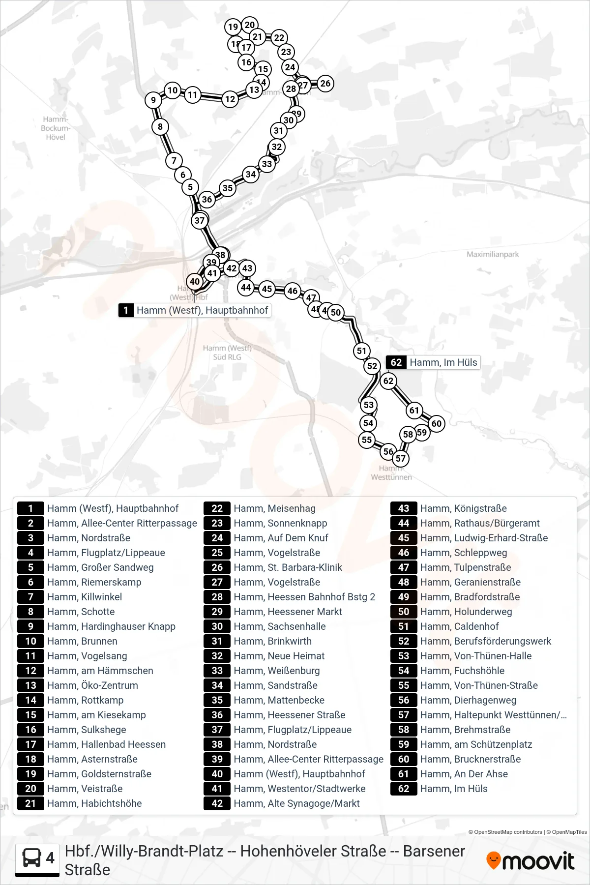
Stops list (4 - Hamm, Im Hüls)
- Hamm (Westf), Hauptbahnhof
- Hamm, Allee-Center Ritterpassage
- Hamm, Nordstraße
- Hamm, Flugplatz/Lippeaue
- Hamm, Großer Sandweg
- Hamm, Riemerskamp
- Hamm, Killwinkel
- Hamm, Schotte
- Hamm, Hardinghauser Knapp
- Hamm, Brunnen
- Hamm, Vogelsang
- Hamm, am Hämmschen
- Hamm, Öko-Zentrum
- Hamm, Rottkamp
- Hamm, am Kiesekamp
- Hamm, Sulkshege
- Hamm, Hallenbad Heessen
- Hamm, Asternstraße
- Hamm, Goldsternstraße
- Hamm, Veistraße
- Hamm, Habichtshöhe
- Hamm, Meisenhag
- Hamm, Sonnenknapp
- Hamm, Auf Dem Knuf
- Hamm, Vogelstraße
- Hamm, St. Barbara-Klinik
- Hamm, Vogelstraße
- Hamm, Heessen Bahnhof Bstg 2
- Hamm, Heessener Markt
- Hamm, Sachsenhalle
- Hamm, Brinkwirth
- Hamm, Neue Heimat
- Hamm, Weißenburg
- Hamm, Sandstraße
- Hamm, Mattenbecke
- Hamm, Heessener Straße
- Hamm, Flugplatz/Lippeaue
- Hamm, Nordstraße
- Hamm, Allee-Center Ritterpassage
- Hamm (Westf), Hauptbahnhof
- Hamm, Westentor/Stadtwerke
- Hamm, Alte Synagoge/Markt
- Hamm, Königstraße
- Hamm, Rathaus/Bürgeramt
- Hamm, Ludwig-Erhard-Straße
- Hamm, Schleppweg
- Hamm, Tulpenstraße
- Hamm, Geranienstraße
- Hamm, Bradfordstraße
- Hamm, Holunderweg
- Hamm, Caldenhof
- Hamm, Berufsförderungswerk
- Hamm, Von-Thünen-Halle
- Hamm, Fuchshöhle
- Hamm, Von-Thünen-Straße
- Hamm, Dierhagenweg
- Hamm, Haltepunkt Westtünnen/Dambergstraße
- Hamm, Brehmstraße
- Hamm, am Schützenplatz
- Hamm, Brucknerstraße
- Hamm, An Der Ahse
- Hamm, Im Hüls