
4 Bus Route Map
View the 4 route map and see all 4 stops along the route. The map of 4 shows where the bus travels and the location of each stop, making it easy to understand the entire route at a glance.
Explore PaderSprinter routes on the map and see where PaderSprinter bus services operate. Use the 4 map to find bus stops and see how the 4 connects different areas along its trip.
All 4 stops on the map are displayed in route order, helping you follow the 4 bus from the first stop to the last.
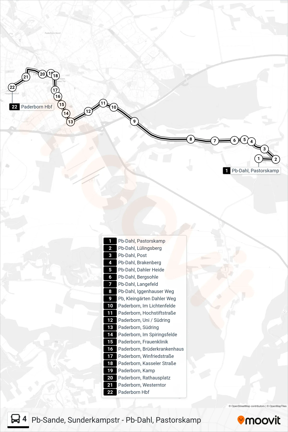
Stops list (4 - Paderborn Hbf Bstg B)
- Pb-Dahl, Pastorskamp
- Pb-Dahl, Lülingsberg
- Pb-Dahl, Post
- Pb-Dahl, Vossberg Richtung Paderborn
- Pb-Dahl, Brakenberg
- Pb-Dahl, Dahler Heide
- Pb-Dahl, Dahler Heide Ersatz Ri Paderborn
- Pb-Dahl, Bergsohle
- Pb-Dahl, Langefeld
- Pb-Dahl, Iggenhauser Weg
- Pb, Kleingärten Dahler Weg
- Paderborn, Im Lichtenfelde
- Paderborn, Hochstiftstraße
- Paderborn, Uni / Südring
- Paderborn, Südring
- Paderborn, Im Spiringsfelde
- Paderborn, Frauenklinik
- Paderborn, Brüderkrankenhaus
- Paderborn, Winfriedstraße
- Paderborn, Kasseler Straße
- Paderborn, Kamp
- Paderborn, Rathausplatz
- Paderborn, Westerntor
- Paderborn Hbf