
4 Tram Route Map
View the 4 route map and see all 4 stops along the route. The map of 4 shows where the tram travels and the location of each stop, making it easy to understand the entire route at a glance.
Explore GBN-moBiel-Stadtbahn routes on the map and see where GBN-moBiel-Stadtbahn tram services operate. Use the 4 map to find tram stations and see how the 4 connects different areas along its trip.
All 4 stops on the map are displayed in route order, helping you follow the 4 tram from the first station to the last.
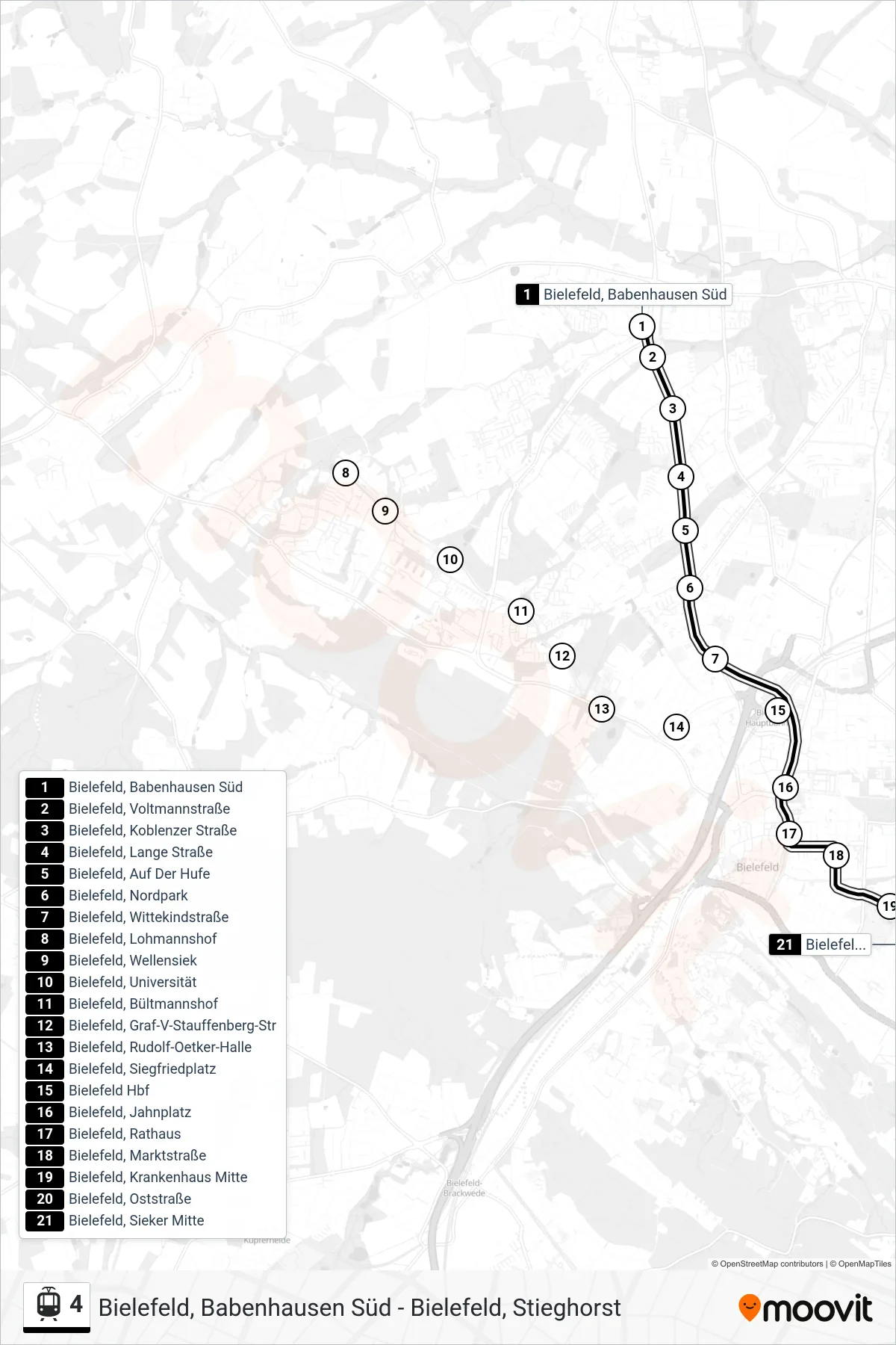
Stops list (4 - Bielefeld, Sieker Mitte)
- Bielefeld, Babenhausen Süd
- Bielefeld, Voltmannstraße
- Bielefeld, Koblenzer Straße
- Bielefeld, Lange Straße
- Bielefeld, Auf Der Hufe
- Bielefeld, Nordpark
- Bielefeld, Wittekindstraße
- Bielefeld, Lohmannshof
- Bielefeld, Wellensiek
- Bielefeld, Universität
- Bielefeld, Bültmannshof
- Bielefeld, Graf-V-Stauffenberg-Str
- Bielefeld, Rudolf-Oetker-Halle
- Bielefeld, Siegfriedplatz
- Bielefeld Hbf
- Bielefeld, Jahnplatz
- Bielefeld, Rathaus
- Bielefeld, Marktstraße
- Bielefeld, Krankenhaus Mitte
- Bielefeld, Oststraße
- Bielefeld, Sieker Mitte