
4 Tram Route Map
View the 4 route map and see all 4 stops along the route. The map of 4 shows where the tram travels and the location of each stop, making it easy to understand the entire route at a glance.
Explore routes on the map and see where tram services operate. Use the 4 map to find tram stations and see how the 4 connects different areas along its trip.
All 4 stops on the map are displayed in route order, helping you follow the 4 tram from the first station to the last.
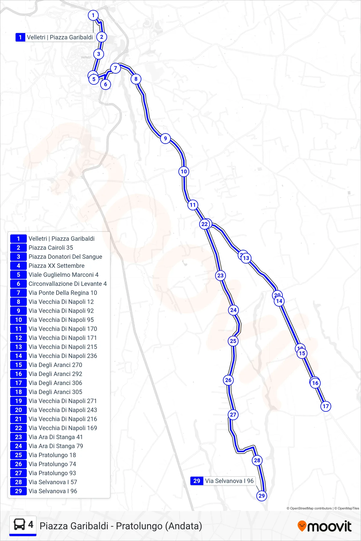
Stops list (4 - Piazza Garibaldi to Pratolungo (Outbound))
- Velletri | Garibaldi Square
- Cairoli Square 35
- Blood Donors Square
- XX Settembre Square
- Guglielmo Marconi Avenue 4
- Eastern Ring Road 4
- Queen's Bridge Road 10
- Old Naples Street 12
- Old Naples Road 92
- Old Naples Road 95
- 170 Old Naples Street
- 171 Old Naples Street
- 215 Old Naples Street
- Via Vecchia Di Napoli 236
- Orange Trees Street 270
- Orange Street 292
- Orange Trees Street 306
- Orange Trees Street 305
- Via Vecchia Di Napoli 271
- Via Vecchia Di Napoli 243
- Via Vecchia Di Napoli 216
- Old Naples Street 169
- Via Ara Di Stanga 41
- Via Ara Di Stanga 79
- Via Pratolungo 18
- Pratolungo Street 74
- Via Pratolungo 93
- Selvanova Street I 57
- Via Selvanova I 96