
4 Bus Route Map
View the 4 route map and see all 4 stops along the route. The map of 4 shows where the bus travels and the location of each stop, making it easy to understand the entire route at a glance.
Explore SolTrans routes on the map and see where SolTrans bus services operate. Use the 4 map to find bus stops and see how the 4 connects different areas along its trip.
All 4 stops on the map are displayed in route order, helping you follow the 4 bus from the first stop to the last.
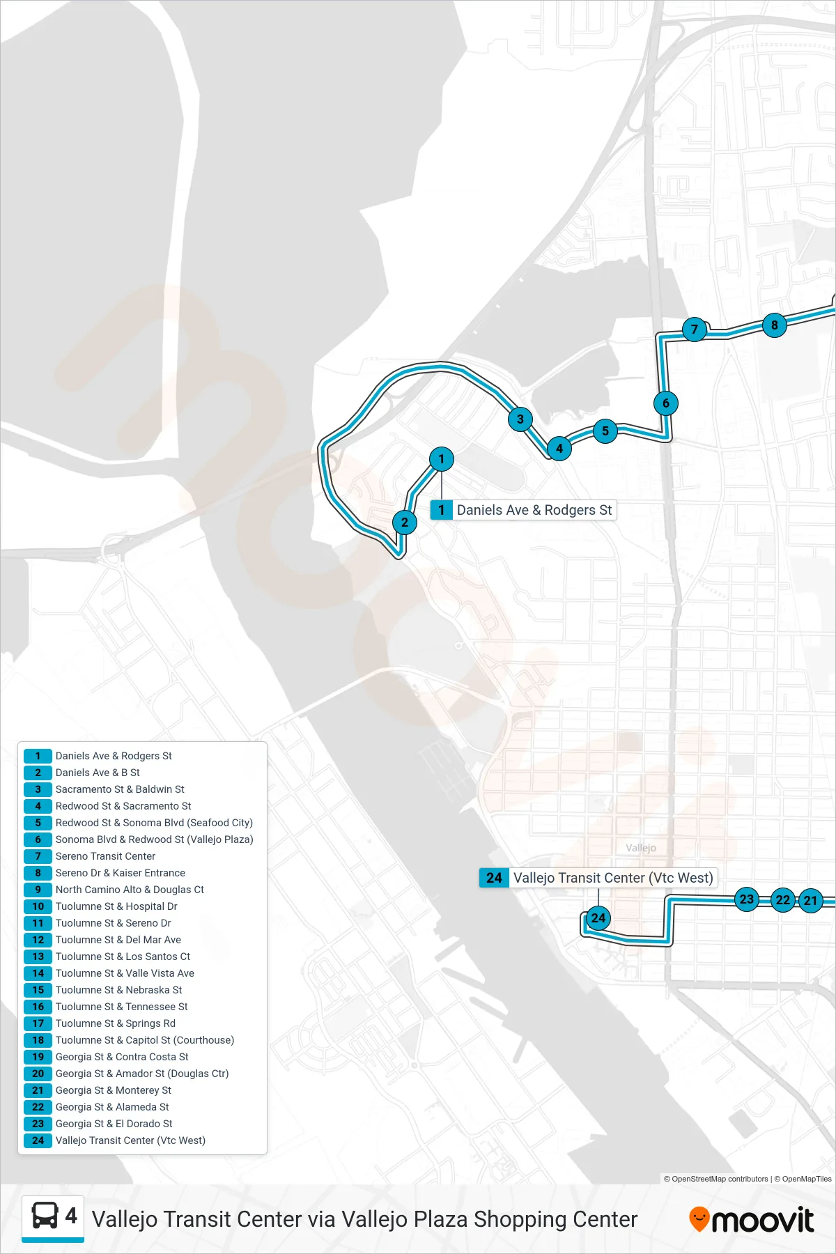
Stops list (4 - Vallejo Transit Center via Vallejo Plaza Shopping Center)
- Daniels Ave & Rodgers St
- Daniels Ave & B St
- Sacramento St & Baldwin St
- Redwood St & Sacramento St
- Redwood St & Sonoma Blvd (Seafood City)
- Sonoma Blvd & Redwood St (Vallejo Plaza)
- Sereno Transit Center
- Sereno Dr & Kaiser Entrance
- North Camino Alto & Douglas Ct
- Tuolumne St & Hospital Dr
- Tuolumne St & Sereno Dr
- Tuolumne St & Del Mar Ave
- Tuolumne St & Los Santos Ct
- Tuolumne St & Valle Vista Ave
- Tuolumne St & Nebraska St
- Tuolumne St & Tennessee St
- Tuolumne St & Springs Rd
- Tuolumne St & Capitol St (Courthouse)
- Georgia St & Contra Costa St
- Georgia St & Amador St (Douglas Ctr)
- Georgia St & Monterey St
- Georgia St & Alameda St
- Georgia St & El Dorado St
- Vallejo Transit Center (Vtc West)