
4. Bus Route Map
View the 4. route map and see all 4. stops along the route. The map of 4. shows where the bus travels and the location of each stop, making it easy to understand the entire route at a glance.
Explore Piteå stadstrafik routes on the map and see where Piteå stadstrafik bus services operate. Use the 4. map to find bus stops and see how the 4. connects different areas along its trip.
All 4. stops on the map are displayed in route order, helping you follow the 4. bus from the first stop to the last.
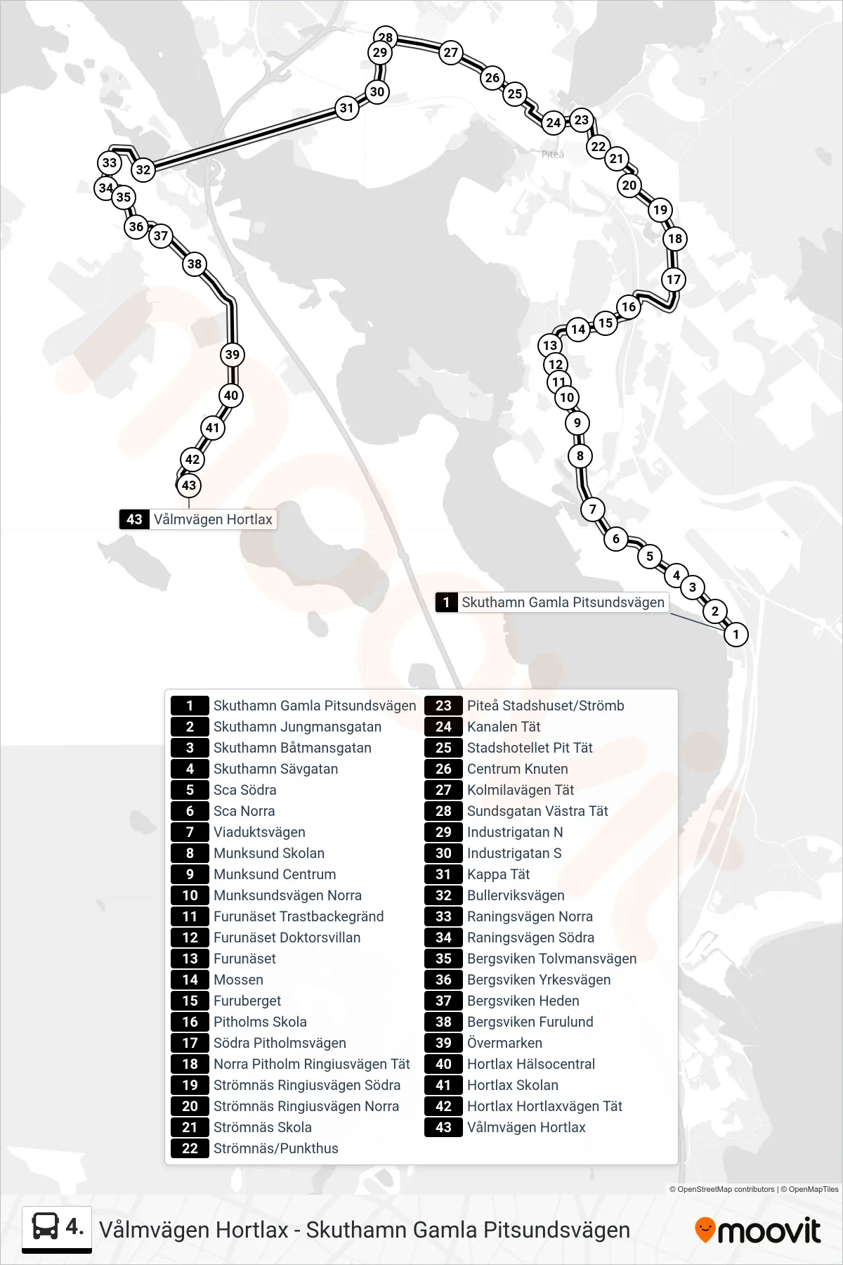

Stops list (4. - Vålmvägen Hortlax)
- Skuthamn Gamla Pitsundsvägen
- Skuthamn Jungmansgatan
- Skuthamn Båtmansgatan
- Skuthamn Sävgatan
- Sca Södra
- Sca Norra
- Viaduktsvägen
- Munksund Skolan
- Munksund Centrum
- Munksundsvägen Norra
- Furunäset Trastbackegränd
- Furunäset Doktorsvillan
- Furunäset
- Mossen
- Furuberget
- Pitholms Skola
- Södra Pitholmsvägen
- Norra Pitholm Ringiusvägen Tät
- Strömnäs Ringiusvägen Södra
- Strömnäs Ringiusvägen Norra
- Strömnäs Skola
- Strömnäs/Punkthus
- Piteå Stadshuset/Strömb
- Kanalen Tät
- Stadshotellet Pit Tät
- Centrum Knuten
- Kolmilavägen Tät
- Sundsgatan Västra Tät
- Industrigatan N
- Industrigatan S
- Kappa Tät
- Bullerviksvägen
- Raningsvägen Norra
- Raningsvägen Södra
- Bergsviken Tolvmansvägen
- Bergsviken Yrkesvägen
- Bergsviken Heden
- Bergsviken Furulund
- Övermarken
- Hortlax Hälsocentral
- Hortlax Skolan
- Hortlax Hortlaxvägen Tät
- Vålmvägen Hortlax