
4 Bus Route Map
View the 4 route map and see all 4 stops along the route. The map of 4 shows where the bus travels and the location of each stop, making it easy to understand the entire route at a glance.
Explore SWU routes on the map and see where SWU bus services operate. Use the 4 map to find bus stops and see how the 4 connects different areas along its trip.
All 4 stops on the map are displayed in route order, helping you follow the 4 bus from the first stop to the last.
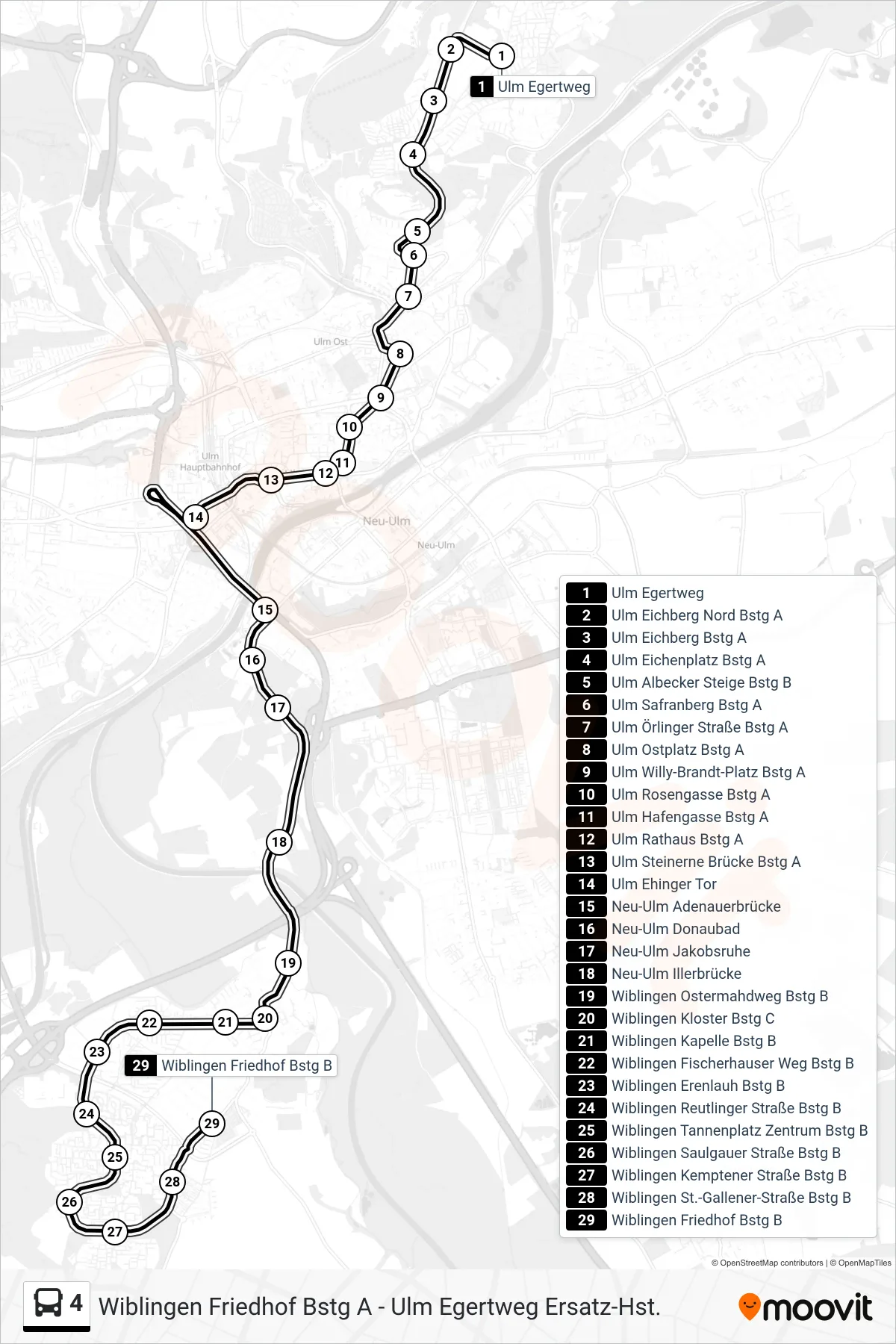
Stops list (4 - Wiblingen Friedhof)
- Ulm Egertweg
- Ulm Eichberg Nord Bstg A
- Ulm Eichberg Bstg A
- Ulm Eichenplatz Bstg A
- Ulm Albecker Steige Bstg B
- Ulm Safranberg Bstg A
- Ulm Örlinger Straße Bstg A
- Ulm Ostplatz Bstg A
- Ulm Willy-Brandt-Platz Bstg A
- Ulm Rosengasse Bstg A
- Ulm Hafengasse Bstg A
- Ulm Rathaus Bstg A
- Ulm Steinerne Brücke Bstg A
- Ulm Ehinger Tor
- Neu-Ulm Adenauerbrücke
- Neu-Ulm Donaubad
- Neu-Ulm Jakobsruhe
- Neu-Ulm Illerbrücke
- Wiblingen Ostermahdweg Bstg B
- Wiblingen Kloster Bstg C
- Wiblingen Kapelle Bstg B
- Wiblingen Fischerhauser Weg Bstg B
- Wiblingen Erenlauh Bstg B
- Wiblingen Reutlinger Straße Bstg B
- Wiblingen Tannenplatz Zentrum Bstg B
- Wiblingen Saulgauer Straße Bstg B
- Wiblingen Kemptener Straße Bstg B
- Wiblingen St.-Gallener-Straße Bstg B
- Wiblingen Friedhof Bstg B